
This walk is set in Snowdonia National Park in North Wales. This walk starts in the “Milestone Buttress” car park on the A5 ca 10 miles from Bangor or 5 miles from Capel Curig.
Parking and Sherpa Bus
Parking is at a premium here, especially at peak holiday time and summer weekends, so a good alternative, especially if you are staying in the National Park, is to use the “Snowdon Sherpa Bus”.
This service travels around the foot of Snowdon, creating a valuable link between the six main routes that travel up Snowdon, as well as the main car parks, villages, and tourist attractions in the area.
It is an ideal service for walkers or climbers who intend to start their journey from one point and finish at another, or indeed for anyone who wish to travel around Snowdonia and leave the car at home. Fares are £2 single/£3 return for an adult.
The service here passes the start point of the walk, but you need to be asked to be dropped off. The official stop is at “Ogwen Cottage”, where our return walk passes by.
Difficulty
It is important to remember that this is a very hard circular route of ca 7 miles. It does involve a certain amount of scrambling, some ridge walking and long steep ascents/descents.
You need to be prepared for all weather conditions and the likelihood this walk will take at 5-7hrs depending on your fitness levels.
It goes without saying that you will be a competent map/compass user and be equipped with the right navigation aids. You need to take water and food to last the day, plus extras in case of emergencies.

This walk avoids the “Bristly Ridge” section of the walk to the top of the “Glyders”, but if you have the energy and head for heights, you can take this route up and enjoy an exposed ridge scramble. It is not as foreboding as “Crib Groch”, but still makes for an exhilarating addition to the route.
So, why do this walk – simply that the views down the Ogwen Valley, over the Snowdon Range and on a really clear day beyond North Wales make the effort all worthwhile.
Start
The walk begins just below the Milestone Buttress, an area of rock made famous as one of “the to do” crag climbs. It was first climbed by OG Jones in 1899.
Cross the stile and you immediately begin the ascent of Tryfan. We start at 300meters and will climb to 900 metres in a little over a kilometre.

The Cannon
As I say this route can be busy, so take your time on the climb, enjoy the views. The “Cannon” – an inclined slab of rock jutting out of the rock face-is a good place to look down the valley and across to the Carnedds.

A Bad Step
There now follows a section of scrambling – not particularly dangerous or exposed, but there is one section, as the locals have it “a bad step”, where you must overcome a wall.
There is room to step back, catch your breath and watch others go up so you can plan your climb, if you have not encountered this type of scrambling before. It is only ca 10-15 feet, and the start is the hardest point, once you have made a couple of steps it becomes straight forward.
Do not be tempted to seek alternative routes, there is an enticing path to the left, but this leads to a more difficult scramble.

The Summit
Eventually you reach the summit and understand the meaning of the name Tryfan – “three stones” referring to the three buttresses on the east face. You know when you reach the top as there are two upright stones – known as “Adam and Eve”.
For the brave you can climb the stones and jump from one to the other and have the “Freedom of Tryfan” bestowed upon you. But as my guidebook says, “make a mistake and the step will be a real lulu”.

You now descend from Tryfan. On reaching Bwlch Tryfan you have some choices.
If you want to shorten the walk there are paths to the left and right that will take you back down towards the A5.
If are feeling fit and up for the challenge you can go forward and up the exposed path of Bristly Ridge.

The Glyders
We took the left-hand path towards a lake known as Lyn Caseg fraith. You then take the right path when you get to a “T Junction”. You are now walking towards the Glyders.
The word is though to be Celtic for “rock pile” and it is appropriate as you cross the blasted terrain. Enjoy standing on the cantilever rocks at the peak of this walk. The views make the effort all worthwhile!

The path becomes a little indistinct but keep walking towards Glyder Fawr across the wide ridge of Y Gribin. You now take the path down towards Lyn Y Cwn – lake of the dog.
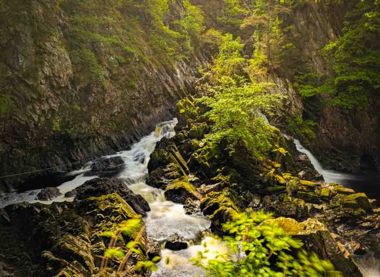
Devil’s Kitchen

The descent starts in a straightforward manor, but soon you arrive at the “Devil’s Kitchen” or Twll Du in Welsh. This seems to translate as Black Hole and is certainly an apt description of the view down at the start of this descent.
It is very atmospheric – steep sheer walls with water running down them and not much light. There is said to be a ghost that haunts this area – that of a walker who missed the path in the mist and fell to his death.
Be warned this is a tricky descent even in the best of conditions. About 500 feet/150m before reaching Lyn Y Cwn take the NE path into a shallow stony gully.
The path narrows as they cut across the Devil’s Kitchen cliffs. There is a short scramble down towards Lyn Idwal.

Walk around the eastern side of the lake, taking time to look back on the descent and the towering cliffs above you. The path now broadens and ends at Ogwen Cottage.
Wait here for the bus, if that is the method you used to get here or walk back along the shoreline of Lyn Ogwen back to the car park.

This really is a stunning walk, but best done in good weather conditions. There are some challenging sections, which can be avoided with careful planning – the Glyders, for example can be walked directly from Capel Curig, avoiding Tryfan and the Devil’s Kitchen. This walk is longer but not quite as strenuous.
Route Details
Duration: 5 to 7 hours

Parking: Postcode LL57 3LZ
Free parking at various laybys on the A5 at Lyn Ogwen


Tryfan is the Mt., and should be first, then the Glyders to devils kichen. Gt walk either way…
Great article. I walked this last weekend. For anyone with more energy in the tank carry on to Y Garn rather than descending down the Devil’s Kitchen. Less spectacular than Tryfan and the Glyders but nice to get all 4 summits into one day. Those who might do the 3 in 5 hours will do the 4 in 7
Thanks David, very interesting, I hadn’t spotted that option. Will give it a go next time I’m in Snowdonia.