
A couple of months ago I started looking at some of the brilliant long distance paths we have in the UK. I settled on the WHW for my first attempt at a solo, multiday hike after seeing photos of the stunning scenery that it has to offer. I bought a guide book and started planning an itinerary based on how far I thought I could comfortably walk each day (annual leave restricted my whole trip to a week). I also wanted to carry all my kit with me for the whole walk and wanted to make it challenging, but enjoyable.
The West Highland Way is a 96 mile (154 km) walk through amazing scenery in Scotland. There are hills to climb along the way too.
I decided that I’d take 5 days to complete the route, walking approximately 20 miles per day for 4 days and leaving myself 16 to do on day 5. Then, depending on how I felt, I’d head up Ben Nevis on day 6 before heading home. Perfect.

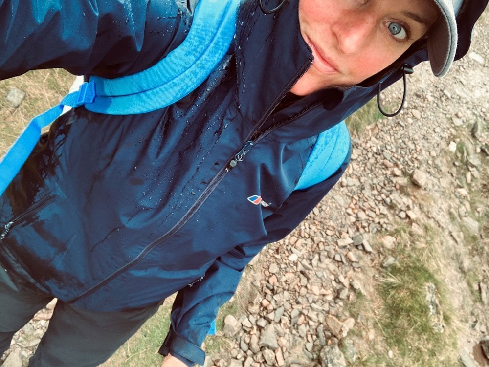
On the 19th of Sept I loaded up my back pack with all my kit and set off on the 4 hour drive to Milngavie where I’d booked into the Premier Inn and where, for a donation, I was able to leave my car while I completed the walk.
Day 1
Milngavie – Milarrochy Bay. 22.5 miles – 7:06:40 moving time.
The start in Milngavie is a little bit strange. I got to the Obelisk in the deserted town centre and asked 2 men sat outside Costa if they minded taking a photo for me. “You’re the 4th one we’ve done in 5 mins” they said with a sigh. I felt like there should have been a banner to walk under or a start line or something but there wasn’t, just a lady pushing a shopping trolley past me as I waved and said “bye” to the obelisk and headed off across the car park.

The first 10 miles or so of Day 1 are pretty uneventful. It’s nice and flat as you head out of the town centre through woodland on well used paths and tracks. There were plenty of people using these paths for walking dogs and running and, as I started on a Sunday morning, this ended up quite a busy part of the route. There’s not much in the way of exciting scenery early on as you wander past farms, cafes, honesty boxes and also the Glengoyne distillery (which is apparently a good spot to visit if you have the time). Once past the distillery you carry on along more well used, flat paths and in what seems like no time you reach the town of Drymen (pronounced ‘Drimmen’), where I headed into the town centre to get lunch. A lot of people use Drymen as their first night stop over because once you’re past here your next campsites/B&B’s are in Balmaha (20 miles from Milngavie) and at the other side of Conic Hill. On leaving Drymen you climb steadily up through the woodland and follow the open path across moorland to the foot of Conic Hill (170m).

There is an option to bypass this climb if needed and take the road route to Balmaha but this isn’t as scenic and you don’t get the views of Loch Lomond from the summit.
Climbing the East side of Conic hill I didn’t see anybody else until just near the summit. The path skirts around the outside of the true summit and you need to deviate 5 minutes from the official route if you want to head up to the trig point. Just as I was about to reach where the track levels off I passed two men heading down the path I had just come up.
“Did you get a good view from the top” I asked them.
“I wouldn’t go up there if I were you, it’s absolutely heaving” they replied.
I’d not seen anyone for the last 2 hours until this point so took what they said with a pinch of salt and carried on.
As I rounded the corner I could then see the path leading steeply up to the left which took you to the trig point and spotted what the two men had warned me about. The path coming up the West side of Conic Hill from Balmaha was like a supermarket queue during lockdown. There must have been hundreds of people trudging their way to the top, all in a slowly moving line. I tried to pick my way down the hill avoiding the crowds like I was in a downhill ski slalom. Conic Hill is a popular tourist spot then!!!
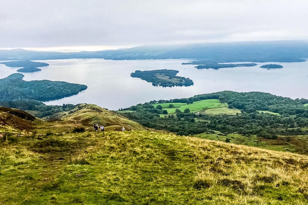
The views from the top were wonderful though, and you could see Loch Lomond for the first time. If it hadn’t have been so busy up there I’d have stopped for a sit down and enjoyed the view for a while. Unfortunately with all the noise it wasn’t the most peaceful place to stop so I carried on down into the town of Balmaha, which was just as busy.
There’s a café here, a shop, pub and an ice cream parlour along with a nice little harbour and frequent boat rides on Loch Lomond. A definite tourist hotspot. I grabbed a bottle of coke from the little shop and joined the path along the side of the loch for the first time. I was to see a LOT of this loch tomorrow.
Finally after 22.5 miles I reached Millarochy campsite and started to pitch my tent. The first section of the loch has a wild camping restriction in place so campsites or B&B’s are your option here unless you purchase a camping permit. When I arrived there were 3 other tents already pitched, all other women walking the way solo and we sat around and had a chat about the rest of our walk. It was here I decided to use the baggage transfer service for the rest of the WHW. The baggage companies collect your bag in the morning and take it to your next destination for you. Easy. I wanted to enjoy the rest of the walk and knew that it would end up being a close call to reach my stops before dark if I carried my bag the rest of the way. Plus I’m pretty sure my back or knees would have a sulk at some point. £30 for the rest of the week for the transfers. Seemed a no brainer.
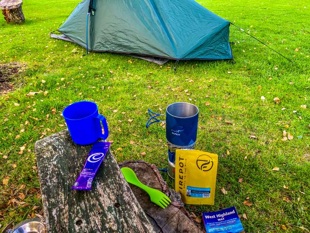
About 8pm a group of 3 arrived on site and spent over an hour arguing about how to put their tent up. It turned out they hadn’t used the tent before now, and this was also their first time camping. The owner of the campsite ended up helping them out and I wandered off and sat by the loch while they shouted at each other, got my little stove out to cook my freeze dried mushroom risotto for dinner (which was a lot nicer than it sounds) then got into bed.

Night 1 I ended up with around 2 hours sleep in total. One of the group of 3 in the tent next door snored so loudly I thought there was a bear on the campsite. I’ve never heard a noise like it in my life. I’d taken ear plugs and also wore my fleece hat and it still kept me awake! Not ideal.
Day 2
Milarrochy Bay – Beinglas Farm. 20.12 miles – 7:45:45 moving time.
After a terrible, broken night’s sleep I got up and started to cook my freeze dried, packet scrambled egg mix (which was absolutely disgusting) for breakfast whilst packing my tent away. The snoring bloke next door was STILL making a racket, oblivious to the fact he’d kept the rest of the site awake all night. I packed everything up ready to be collected by the transfer company at 8am. Now I knew I didn’t have to carry my bag I just stuffed all my kit in any old way, instead of neatly placing it so it was well balanced like before. One of the other girls that had decided to keep carrying her bag had already left the campsite at 6:45am to get a head start as she was heading to the same place as me that day.
Because I hadn’t brought a day pack with me for essentials, and all my kit was packed away and going on the bus, I’d checked my map and spotted that at 10 miles in there was a hotel with a ‘walkers café’ attached to it later on today. Lunch stop planned out I set off, knowing I could make it to there with nothing, and the weather was looking good so I didn’t need to carry my waterproofs. Perfect.
My bag dropped at the little hut on the campsite I headed off for the 20 miles along the edge of the loch. The path for day 2 starts along the edge of the loch and on this Sept morning it was absolutely pan flat, not a ripple. Lovely.

The views were wonderful and it was completely silent. You soon pass the end of the path that heads up to the right towards Ben Lomond (974m). This is also a popular detour if you have the time, but I continued along the path that hugs the side of the loch.
I soon realised I’d massively underestimated this section of the walk. I’d presumed that as it ran along the side of the loch it would be flat. WRONG. Very wrong. Small winding paths, slipperly rocks, some bits that needed a scramble and steep step downs made it very challenging and I was so glad I’d decided to ship my bag. I passed the girl that left over an hour before me this morning, with her bag, and she was already struggling. The heavy bag was throwing her off balance on the technical paths. She was making slow progress and muttered a “fine” when I asked her if she was ok.
Having had no snacks, food or water for 4 hours I was chuffed to bits to see the Inversnaid hotel come in to view at the other side of the waterfall. I was so hungry and planning what I was going to order for my lunch as I walked down the long concrete stairway to the front of the hotel and…
“CLOSED”
…oh no.
Luckily for me there was a water tap on the outside wall that was still in use so I drank out of my hands as much as I could but I was going to have to carry on having had no food!! I looked at my watch, 10 miles to go, better get a move on. I had been walking for 4 hours now and I was going to have another 4 hours or so to walk with no fuel. Oops. Not clever.
The part of the route after the Inversnaid hotel is even more challenging than the previous 10 miles. The path got narrower, more slippery and much more technical. I trudged on, climbing over rocks and ducking under branches all whilst thinking about food. I passed the sign for the entrance to Rob Roy’s cave but didn’t fancy climbing down to the water’s edge to see it by this point.

17 miles in and I was still on the path at the side of the loch. It felt like it was going on forever. I looked to my left “oh you’re STILL there” I said to it. I checked my little book, 3 miles to go it said, at this slow pace that should be just over another hour. Keep going.
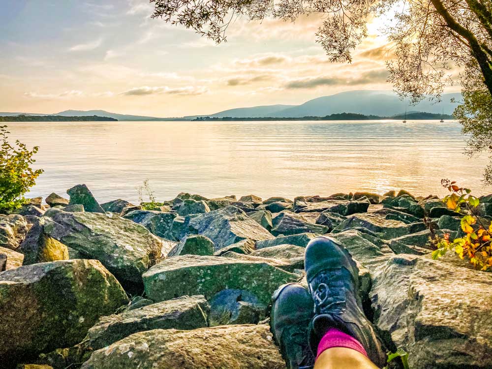
Finally, at 18 miles in, I looked over my shoulder and saw the loch for the final time as I passed over the hill at the north end of it and started the descent to Beinglas. I gave it a wave goodbye, or good riddance, and carried on. I was happy that section was over.

By this point I was tripping over stones, clumsily, because I was absolutely out of energy. Over 7 hours of tough walking on a packet of grim scrambled eggs was definitely not enough. I reached the campsite in a daze and was over the moon to see they had a bar on site that served food. I’d been told about another pub about half a mile away, and that had been my original plan, but I couldn’t walk another step. I gave them my name, ordered the Beinglas belly buster burger, 2 cans of coke and extra chips and slumped in a corner of the pub until my food arrived. Within half an hour of eating my burger and drinking some fluid I felt fine again and ended up putting my tent up in record time. I’d topped up the energy levels again.
I was sitting outside the pub around 2.5 hours after I arrived at the campsite that evening when the girl I’d spoken to the night before, who carried her bag that day, arrived there too. It had taken her almost 4 hours longer than it had taken me and made me grateful I’d used the baggage service that day. She decided to use it from then on as well. She showed me her shoulder and they were red raw from her bag straps.
That night, tent up, full of food and after almost 8 hours of walking and 2 hours sleep the night before I was asleep in record time. No snorers.

Day 3
Beinglas Farm –Inveroran. 21.37 miles – 7:06:40 moving time.
Even though I’d inhaled a massive double cheeseburger and chips the night before I still woke up at 5:30am really hungry on day 3. That huge burger still didn’t come close to filling the massive deficit of the day before so I swerved my packet scrambled eggs that morning and had a sausage and egg sandwich and latte from the campsite café before I set off. I also bought a little £12 day pack from the shop there to carry snacks and my waterproofs as it was forecast to rain that day and I definitely didn’t want to make the same mistake with food again!!!!
Leaving the campsite and walking along the path across the moorland that morning was absolute bliss. I’d slept well, I felt good, the sky was clear, the sun was coming up behind the mountains and I was completely alone. It was wonderful. The path skirts the small village of Crianlarich then heads up steeply through pine woodland, it really was great and every so often you could see the mountains through the gaps in the trees. Again I saw nobody for the first 3 hours of day 3.
About 3 miles in you pass Pine trees Leisure Park, and their wigwams. The trouble when you’re alone is you get songs into your head and from this point onward it was “Wig Wam Bam” which I then continued to annoy myself with for the rest of that day, on repeat. Every time I thought it had gone, it came back. I cannot sing a note in tune either which made it worse. Shouldn’t have read that stupid sign!
12 miles in and I got to Tyndrum just as the rain started. I sat in the café and ate a jacket potato while putting my waterproofs on, stocked up with more snacks, and knew I was going to have to walk the next 8 miles in the rain. My cheapy little rucksack was not going to be waterproof so I bought a poncho from the gift shop to cover my bag and set off for Inveroran.
The next 8 miles I couldn’t see much of the views as the rain came in. I passed an older couple who said to look out for a viaduct further along the route that day but I never spotted it so presume it got hidden by the rain. Most of the rest of day 3 was spent looking at the ground to avoid getting rain in my eyes. It was getting much colder by this point as well. Luckily I had purchased some really good waterproofs so my clothes underneath were staying dry, for now.
I reached the Inveroran hotel where my bag had been dropped and I was absolutely soaked by this point. The hotel bar looked so warm and inviting but was closed due to Covid so I collected my bag from the shed outside and went for a wander to try and find somewhere to pitch my tent. I found a small forest not too far from the hotel and thought that might be a bit more sheltered as the rain was due to get really heavy overnight. I hurriedly put my tent up trying to keep it as dry as possible, took my wet clothes off and put as many dry clothes on as I had. There’s not much room in a one person tent so my bag, my waterproof coat and trousers and my boots had to stay in the gap between the sleeping compartment and the outside. The ground was so wet out there so I knew there was no way they were going to dry overnight. I checked the forecast for the next day and luckily the rain was due to stop at midnight. Phew. I wasn’t looking forward to having to put wet waterproofs on again the next day, although I knew my boots were not going to dry in time.

It was about 6:30pm when I pitched my tent but that was me for the night. The rain was hammering it down outside and I was already in my sleeping bag curled up trying to keep warm. I had every dry item of clothing on but was still feeling cold. I had a feeling this wasn’t going to be a good night’s sleep. Again.
It got to about 9pm and I needed a wee. It was now 0 degrees outside and still raining heavy. I was just about keeping warm in my sleeping bag. I had a dilemma. I didn’t want to go out in the rain and get all my dry clothing wet as I didn’t have anything else to put on. I looked at my little plastic mug. That was my coffee mug for the morning. That’s would be the solution. But, if I wee in my coffee mug there’s no coffee in the morning, and it’s 10 miles until a café on day 4. It was still raining heavy on the tent though.
No coffee or getting soaked through and cold?!?!
I chose not to have coffee on Day 4. Thank you coffee mug.
Day 4
Inveroran – Kinlochleven. 19.10 miles – 6:12:54 moving time.
Another terrible night’s sleep last night. This time it was because of the cold. The temp had dropped to -1 overnight and my sleeping bag was only good to 6 degrees. No wonder I’d been cold. My waterproofs hadn’t dried out and my bag was wet on the bottom. Fun times.
I got out of the tent and looked down the valley to see a wonderful sunrise. The rainclouds had vanished and even though it was really cold, the sky was going to be clear all day. This soon cheered me up, today was going to be a brilliant days walking. I just knew it.

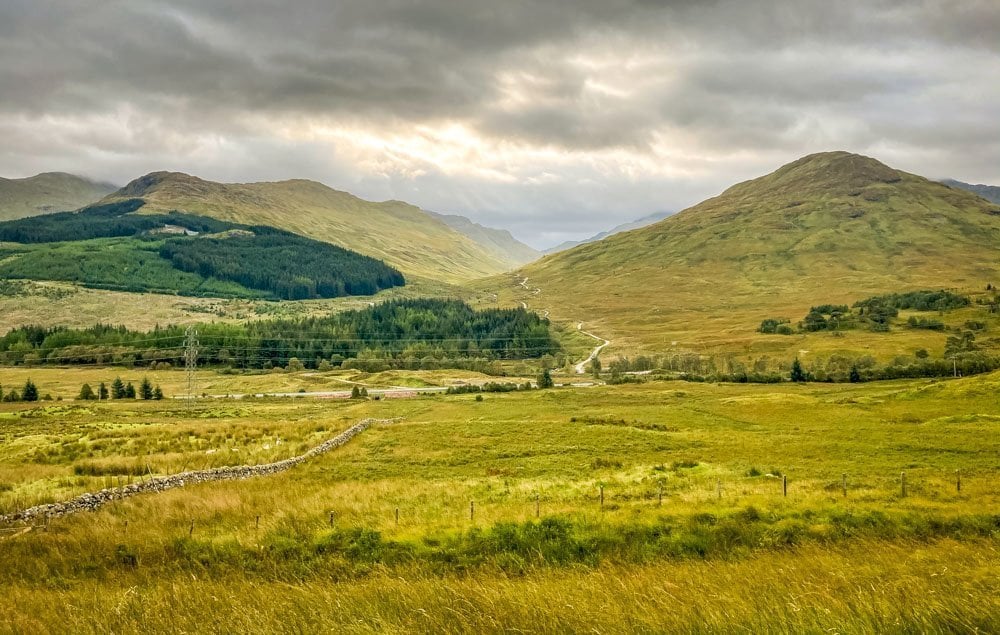
I wiped down my tent the best I could and packed it away. My hands were so cold I just wanted to get going so I could warm up. Tent packed away, bag dropped in the shed behind the hotel I set off on the 7 mile gradual climb out of Inveroran over to Rannoch moor. There were deer and stags along the side of the river in the mist of the morning and it was amazing. As I climbed I ended up looking across at the cloud inversion and once I’d got above that the weather was stunning. I soon warmed up and 2 miles in my gloves and jacket had come off and I’d tied my waterproofs to the straps of my bag to dry them off in the sunshine.

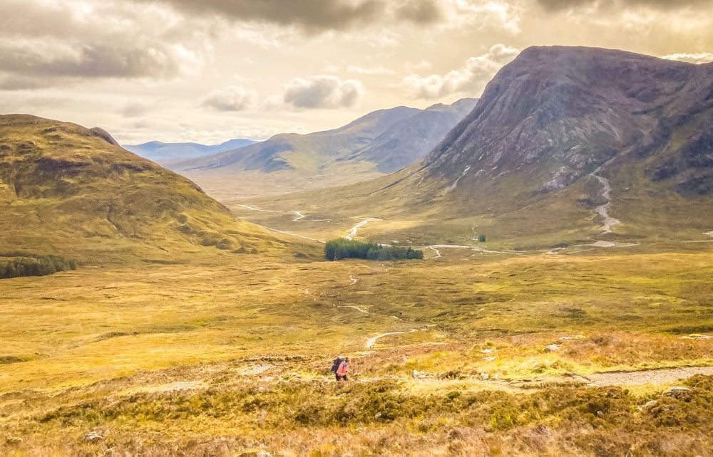
Rannoch Moor is a popular wild camping spot along the West Highland Way but I didn’t see one tent on this day. In fact, once again, I saw nobody from Inveroran to The Kingshouse hotel at 10 miles in. It was deserted across the moor, so quiet, sunny, still and peaceful. I was totally in my element.

You drop off Rannoch Moor, past the Glen Coe Ski resort and then at 10 miles in I called in to The Kingshouse hotel for a coffee. They have a campsite here although the lady behind the counter said they’d had nobody stay there for the few weeks. £4.50 later I had a tiny latte and it was another £6.50 for a ham sandwich. Yorkshire folk are known to be tight so I grumbled to myself but the coffee and sandwich tasted great after last night’s packet food and no coffee this morning. £11 lighter, I carried on.
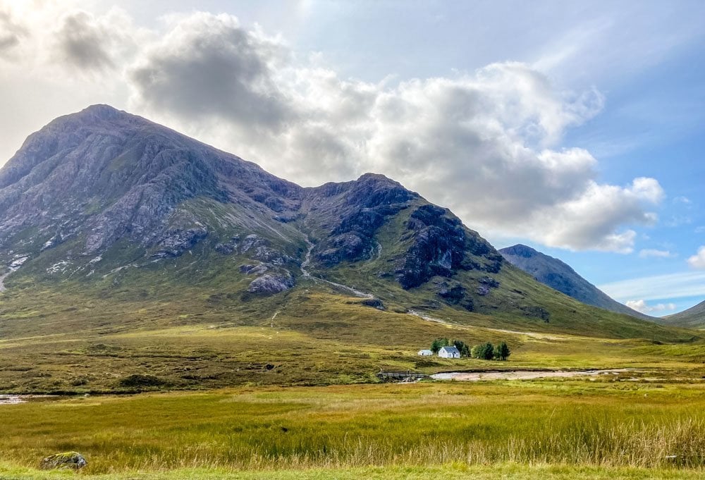
From the Kingshouse Hotel you follow the path that runs alongside the busy and loud A82 which completely ruins the peace and quiet, until you turn right and start to climb the Devils Staircase. 75 miles you’ve walked up to this point and you come across this 548m climb. I saw other people again at this point as this part of the route is popular with day tourists. You can see it weaving its way up the side of the mountain, and it is quite a slog, but somehow turning around and seeing the amazing views behind you make it quiet enjoyable. There’s a solo white cottage at the foot of the mountains here and it’s on many a photo depicting Scotland’s Highlands.
Over the summit and you get your first glimpse of Ben Nevis in the distance. The end goal.
Now, what you don’t expect at this point is how tedious and painful the descent into Kinlochleven is going to be. Its downhill, it’s on hard ground and it is LONG. You can see the town in the bottom but it never seems to get any closer. By the time I reached the campsite at the bottom my feet were shot, the bottoms of them burning like mad. The last mile of that descent everyone is walking like robots. It’s quite funny. A proper quad killer.

Into Kinlocheleven and I put my tent up at Blackwater campsite as quick as I could as the sun was out and I was hoping it might dry a little before I had to sleep in it again. I hung my wet clothes over the fence and went to have a hot, welcomed shower. Great facilities here.
I got chips with cheese and gravy from the chip shop for dinner, had a bit of a chat with some others on the campsite, and went to bed.
Day 5
Kinlochleven – Fort William. 16.5 miles – 5:28:00 moving time.
I woke up early, excited for the final day and the prospect of a nice comfortable bed at the Travellodge in Fort William that night. I knew I ‘only’ had 15 miles to walk today so wanted to get going. I put my walking socks on with my sealskinz waterproof socks on top of that, then put my feet into my still wet walking boots. My boots smelt absolutely awful by this point. They had been wet for 2 days and even when they were outside the tent that night I could still smell them. They were heading for the bin once I was home. They have served me well though.
I spoke to a fellow camper that morning and he was telling me about his pre hiking breakfast of choice. He crushes up his favourite biscuits, adds custard powder, then a small amount of hot water, leave for 5 mins, and eat. It looked awful but he assured me it tasted great. I turned down his offer of tasting it, bought a bag of skittles and a sandwich from the coop and set off on my final day.

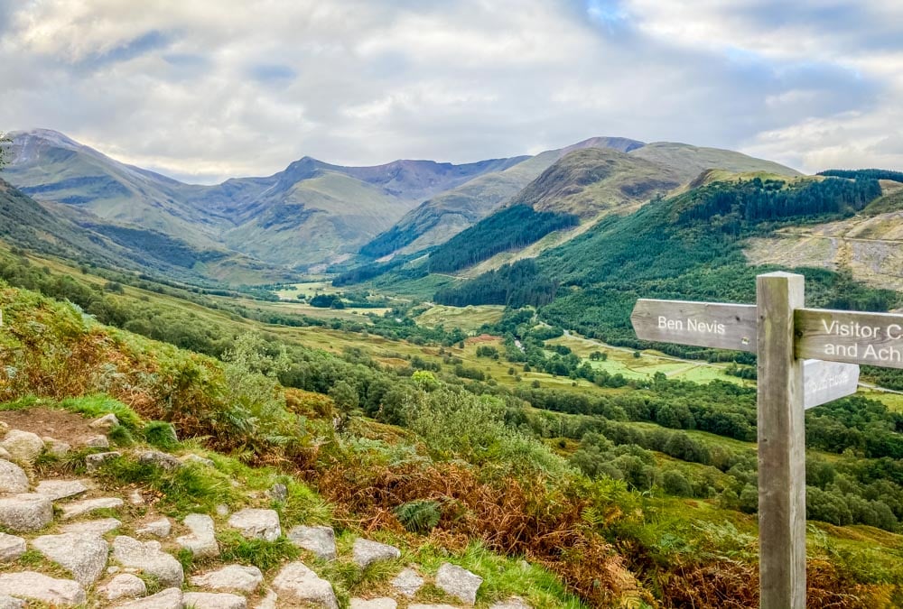
I headed out of Kinlochleven and you have a 3 mile (250m) climb to contend with early on. Good to get the lungs working on a cold morning. The sky was clear, the weather was bitterly cold and I was in the middle of nowhere. It was the perfect start to my final day. Once at the top of the first climb the well-used track then heads along the moor past a couple of derelict buildings but mainly with nothing but mountains in sight for miles and miles. I was singing away to myself along here. Tapping my walking pole on the rocks and just enjoying the peace and quiet.

About 7 miles in I passed a man who was carrying 2 tents, 3 sleeping bags and 2 rucksacks by himself. He had retrieved someone else’s tent from the top of the moor that had been left next to the ruins. They had abandoned it in bad weather 2 weeks previously and it had been there ever since, untouched. He had dismantled it and was carrying it back to Fort William to post back to the owner. I stopped and offered to carry some bits for him but he refused “it’ll do me good” he said. I later spoke to him at the finish and that was his 47th time walking the West Highland Way. He was also returning on October 4th for walk number 48. What a guy!!
The final stretch was actually quite challenging. The path was hard underfoot, my feet were tired, my boots were wet and I was ready for a good sleep. All I had to do was look around though and I realised there was nothing else I would rather be doing. The scenery there is breathtaking.

Ben Nevis came into view again and you then continue to see it right until Fort William. The final small, winding path goes through a forestry area which at one point would have been quite nice but now it’s a bit barren, open and depressing, with dead trees littering the path.
My guidebook gave 3 alternative finish routes for the West Highland Way. The ‘original’ route heads down to the A82 and you walk the last 1.5 miles along the main road which didn’t sound overly appealing. I chose a route that took the ‘Peat Track’ route to the finish, which also added an extra 1.3 miles to the day and another 200m of elevation. Good choice, Mel. I took a left before the route joined the A82 and climbed again, up to Cow Hill. “Oh man, I’ve made an error here”. Up to the top of Cow Hill and I was sweating like mad, even my kneecaps were sweating. It was so warm, usually so for Sept by now. I rummaged around in my bag and found a bottle of coke that was warm and flat, I tasted it, then binned it. Vile. 2 miles to the finish. I’ll get a cold one then.
I could see Fort William as I went over the top of Cow Hill and the path I took followed the back of the houses before dropping down to the town centre.
What an absolute mood killer the finish is. You drop down into the main shopping high street of Fort William and head to the finish which is a bench, marked with a statue called “Man with sore feet”. You’re walking along, having covered almost 100 miles on foot, proud of your achievement, smiling away to yourself and you end up walking past people doing their shopping and going about their day as normal. It’s all a bit weird. They changed the original finish point in 2010 so that you now have to walk down the high street to finish the route. A cunning plan to get people to buy tatt, whisky or the novelty t-shirts hanging outside the gift shops.
I reached the bench, the finish line, the end of my solo journey and found a little old couple sat eating fish and chips, one each side of the statue. I sat on a wall a little bit further away and waited patiently for 25 mins while they finished their lunch and wandered off.
Yey. Now I can get my finish picture.
I asked another walker if they minded taking my photo while I stood awkwardly next to the statue. “Why not sit on his knee” he said. So I did.

And that was it, there wasn’t anyone else around by now so I collected my bag and went into the Travellodge for a bath. My friend Ben messaged me to ask if I’d cried at the finish, but I hadn’t. ‘Should I have done’? I thought. I was extremely proud of myself and my body for covering what ended up being 99.25 miles in 4.5 days, alone, through absolutely amazing scenery. I hadn’t wanted it to end and if annual leave hadn’t have been a factor I’d have been very tempted to carry on along the Great Glen Way, another long distance walk, which starts in Fort William and finishes in Inverness.
That’s one for another time though.
Day 6
Ben Nevis
I decided to tag a summit of Ben Nevis on to the end of my adventure. It was always a ‘maybe’ depending on how I felt after completing the WHW but surprisingly, I felt pretty good when I woke up on day 6. My transfer back to Milngavie wasn’t till 4pm so I thought I’d set off up the ‘tourist route’ and see how I got on. My original plan was to take the CMD route to the summit, which is much more challenging and generally quieter. The forecast that morning said snow, hail and high winds at the summit so, with going up alone, I decided to take the more frequently used route.
The path up Ben Nevis has been paved lower down and the first 1.5 miles is like climbing a giant staircase. A group of over eager lads went storming past me in this first mile, “see you in a bit” I smirked to myself as they flew past. The path then levels out around 2 miles in and sweeps round to the right up a much gentler incline. Here I passed the group of lads who were all sat on the grass, red faced and sweating. “Peaked too soon have you?” I said to one of them, and they all laughed.
The sun was shining at this point and I was in a short sleeved t-shirt. Great views.
About 3 miles up the path turns to climbing over small boulders, then eventually to slippery slate.
As I reached the first of the cairns I headed into the mist, then rain, then light snow, then hail!!! Wow, that changed quickly. I had my waterproofs on by this point, along with my gloves.

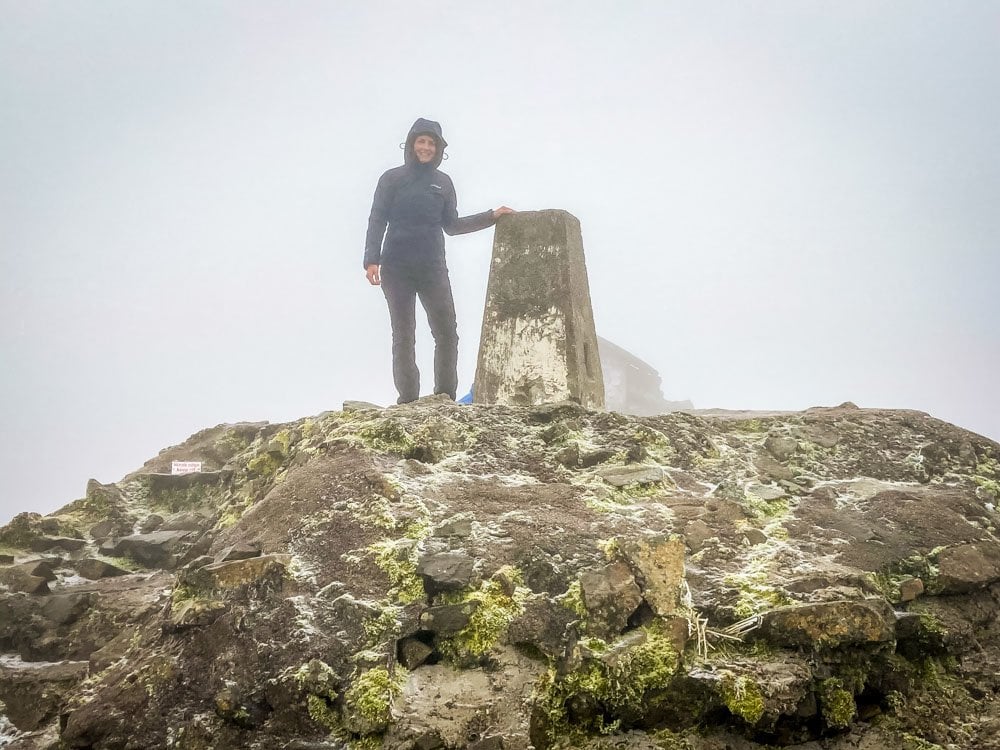
Like any mountain, you think you’re at the summit, then it carries on for much longer. Every time a cairn appeared in the mist I thought it was the summit one, nope. I followed the various cairns across the plateau and eventually came to the summit trig. There were about 5 other people there that morning and I asked one to take my photo, then headed straight back down. It was too cold to hang around.
As I was descending in full waterproofs and gloves I passed people heading up to the summit in t-shirts and shorts. Some without a bag or coat with them. They were going to have a surprise within the next hour!! A few people asked if I’d reached the summit and when I replied that it was snowing up there I could see them look at me and think “yeah, of course it is”.
I followed the tourist path all the way back to Glen Nevis campsite, where I’d started from, and got a taxi back to Fort William in time for my transfer back to Milngavie at 4pm.
Total distance from Glen Nevis campsite was 9.84 miles reaching an elevation of 1344m using the tourist route.
Adventure over.
Now to plan the next one…
Recommendations
If you’re planning on walking the West Highland Way I’d recommend using the baggage transfer service if you decide to walk more than 10 miles a day, for enjoyment reasons. The company I used was called AMS Scotland and they were great.
You can get back to Milngavie from Fort William using Baggage Freedom for £25. It’s a mini bus with 6 seats so book early but it only takes 2:15 hours. The train is almost 4 hours and they are infrequent, although it is more scenic.
Tag a summit of Ben Nevis on to the end of your trip if you have time.
Well walked boots and socks are an absolutely must. I met so many people with huge blisters from new boots/socks.
Remember snacks.


Hi Mel,
Great to read this and see that it’s doable for a woman alone. I always worry about having enough maps and getting lost etc! It sounds like you only had the guidebook and not OS maps too?
And was it easy to follow? cheers Alison
Great review. I appreciate your sharing your journey and thoughts.
Thanks for this. Your pictures and description match mine from my trip with my two adult sons about 15 years ago. You’ve reinforced some great memories.
This was an amazing article/read thanks for sharing and lots to rethink about.
Well done.
Your comments are very helpful.
I used B&B and bunkhouses…..so my rucksack was just wet weather gear and clothes.
It could be gruelling at times, yet I was sad when it was over.
Suppose that says everything
I was the same, Alan. It was so exciting in the run up to doing it and then all of a sudden it’s over.
Mel Sykes: how did you manage to keep your phone battery topped up to enable you to take photos for the four days whilst you were camping; do you have some sort of battery backup that allows for multiple recharges along your route ?
Hi Nigel. I use a solar charger to charge my phone. It just needs an hour or so of daylight each day to give it a full charge and that lasted for the whole week.
If using the baggage transfer option, surely there is no need to be as light as possible, rather take what you need to be warm, dry, and comfortable; possibly a slightly larger tent, warmer sleeping bag, more dry clothes and socks, and better food; plus a decent waterproof small day sack; not necessarily over the top, but will only need to carry it for short distances !
Enjoyed your travel log and photos immensely, now awaiting the next instalment !
Oh absolutely. I would definitely pack extra kit if I did it again and used the transfer bus.
The only reason I’d tried to get it as light as possible to begin with was that I was hoping to carry it the whole way!