
I’ve always had a yearning to walk a Long-Distance Path (LDP) but never seemed to find the time. But after reading from one my fellow authors here, Mel Sykes’s story of her solo walk on the West Highland Way I thought I should just put on my Nike face and “Just Do it”.
But which path to choose? There would appear to be over 1600 routes that qualify as LDP, in the UK alone!
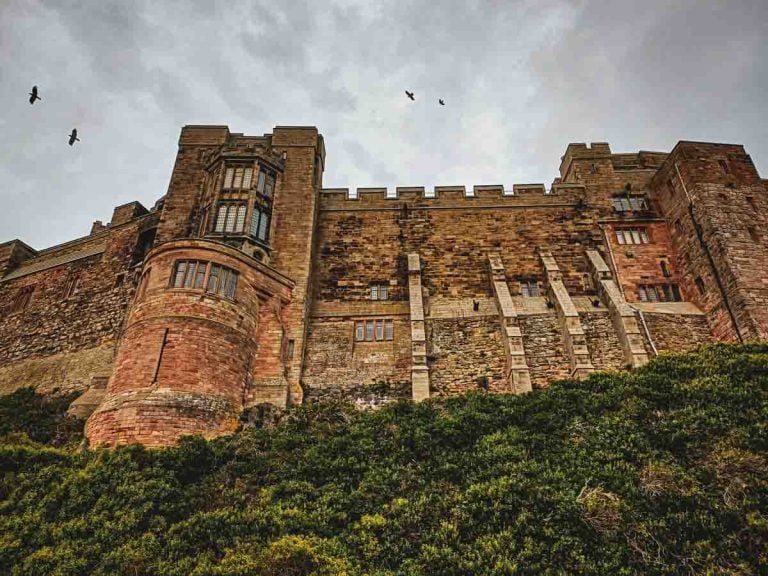
The decision was made for me, when my wife booked a cottage for a holiday near Hexham in Northumberland. Hadrian’s Wall it was.
The Hadrian’s Wall walk, at 84 miles (135km) long, it was clear I would have to do some serious planning if I was to complete the walk in my allotted 6 days.
Firstly, I invested in a decent guidebook. The publisher “Cicerone” is renowned for quality guides and the book they publish by Mark Richards “Walking Hadrian’s Wall Path” is no exception. It comes with detailed stage routes, suggested itineraries covering 5, 8 and 10 days, ideas for accommodation plus a handy 1:25,000 route map in a booklet form. No need to carry several bulky maps.
I persuaded a friend that he would like to do this walk as well. So, we had the luxury of 2 cars meaning we could drive each day to the start and end of the days route, rather than relay on public transport, or plan accommodation for each night. Although Mark’s book is very helpful if you need to plan such a journey.
We also agreed that a West to East route would be best, as the prevailing wind and rain would be at our backs!

History of the Wall
Emperor Hadrian Aelius came to power in Ad117, inheriting a whole raft of issues with his northern empire, not least the Pictish tribes of Scotland.
The solution, as Hadrian saw it, was to build a wall to separate the barbarians from Romans. Work started in Ad122 and took 10 years to complete.
The wall was around 10 feet thick, 15 feet high with integrated forts evry 5 miles and look out points or “milecastles” every mile. A double banked ditch and roadway ran alongside the wall. However you look at it, this is an impressive piece of engineering.
The whole enterprise was manned for over 300 years until the withdrawal of the Roman Army because of the declining power of the Roman Empire.
Over the centuries, following the Roman departure, requirement for farmland and housing lead to the destruction of the wall.
The most visible remains are in the central section, which is not surprising as this is the least densely populated area and the most difficult to farm.
In 1987 the entire wall was awarded World Heritage status by UNESCO in recognition of the fact that this is still one of the finest surviving remnants of the Roman Empire.
The Wall today is looked after and maintained by various bodies, such as English Heritage, The National Trust etc. and whilst there may be a charge to enter some of the museums such as Birdoswald, the wall is free to visit and explore. Some 12000 people a year walk the entire wall, with countless others visiting for day or weekend walks.

Day 1
Bowness-on-Solway to Burgh-By-Sands – 8.25 miles (13Km)
The first thing to note is that 8 miles is a lot less than the average 14 miles per day we would need to do if we were to complete the journey in 6 days.
I must confess that after reading Mark’s guide book some sections seemed a lot less appealing than others and therefore, we did not feel the need to do every mile.
We omitted the section from Burgh-By-Sands to Newtown and saved 16 miles. This section was largely flat and urban with little of intertest to us – I apologise now to the citizens of Carlisle and I’m happy to say that it is a fine city with a lovely cathedral and castle that are well worth a visit, but it wasn’t part of our plan, this time.
The “official” start of Hadrian’s Wall is tucked away down a side path in the village with little fanfare to proclaim it. A small pavilion marks the start or end with a lovely view over the Solway Firth.
There is little evidence of the wall over the next few largely flat miles but the views across to Scotland are stunning and the archaeology of Port Carlisle make up for this.
This area was developed as a means to receive lager sailing ships and transport goods and passengers to Carlisle by means of a canal then later a steam train.
Unfortunately, the coming of steam ships made this operation unviable and all that is left is the impressive mooring/bridge points.
The walk then tracks across farmland and then follows the line off the disused railway to Burgh-By-Sands. Spend some time in the village and look at St Michael’s church and Aballva Roman fort.
You can see Roman carvings, the wall itself, and a beautiful stained-glass window. The structure of the church with its buttresses and arrow slits tells of the violent times along the border following the death of Edward 1 from dysentery at Burgh-By-Sands as he made his way to fight Robert the Bruce.

Day 2
Newtown to Birdoswald – 8.25 miles (13Km)
The countryside now starts to take on a different aspect; it becomes hillier but is not unduly hard walking. Although most of the stone was removed from the wall in this area for the building of Lanercost Priory and Scalby Castle, you start to see the features of the wall.
For me this was quite an exciting day as the archaeology gradually became more and more prominent – it felt like unwrapping a present – until just after the village of Banks, the wall was entirely visible and the milecastles gave a sense of what it would be like standing watch, looking north towards Scotland.
You now walk alongside the Roman Military Road and as you approach the Roman fort at Birdoswald you do have a sense of how much manpower it would take to maintain this area and the industry that would prosper from providing food, clothing etc. to the army based here.

Day 3
Birdoswald to Steel Rigg – 9.5 miles (15km)
Now we start to get into the “classic” section of Hadrian’s Wall, the walking becomes a little more strenuous, the countryside wilder and more remote.
The sections of the wall are very impressive, the views in front of you towards Walltown and Winshields become quite imposing and as you near them you can’t quite believe the wall was built over these hills and crags.

On leaving Birdoswald you immediately come across impressive sections of the wall, with engravings in the bricks of the legions who built this section still visible.
On leaving the town of Gilsand you start to follow the wall ditch and, in some cases, walk in it – this gives an interesting perspective on how this formed a second formidable line of defence, should the wall be breached.
We spent some time looking round the ruin of Thirwall castle built from the stone of Hadrian’s wall.
Shortly, we passed through the quarry at Wall Town and walked alongside the wall over Win Shill – the views are now really impressive, and I marvelled at the engineering skills to build the wall on the undulating edge of this escarpment, leading to the highest point of the walk – WinShields Crag at 345M.
From here we descended to the end point of the day “The Sill” Northumberland NP’s visitor centre.

Day 4
Steel Rigg to Brocolitia – 8 miles (13km)
This was my favourite part of the walk beginning with a short but very steep ascent to the Peel Crags.
The wall/path is very undulating on this section – rather like some mighty roller coaster, but the scenery is simply stunning. This section includes the iconic Sycamore Gap – made famous in Kevin Costner’s film “Robin Hood, Prince of Thieves”, you can actually walk on the wall as you approach Housteads Fort, and the views unfold around you. Paul Steele wrote about walking this section of Hadrian’s Wall, so for more detail, see that.
The walk-up Sewing Shields Crags is steep, but not too long and provides wonderful views north to Scotland and south over Northumberland. We had our lunch here, just enjoying the panoramic views and solitude.
The path then descends and is flat for the rest of the walk, passing through a Roman temple until you reach Brocolitia.

Day 5
Brocolitia to Portgate – 9.5 miles (15km)
The path continues to flatten out and becomes a broad plateau giving expansive views to Scotland and south over Northumberland.
Apart from the descent into and ascent out of Chollerford, it is fairly undemanding, leaving plenty of time to admire the views in this area as well as enjoying the sights at Cilurnum Fort and Chesters Museum.
At Chollerford we crossed the Tyne and had a diversion to view the ancient crossing at Chesters Bridge. There is a lovely stretch of wall at Brunton and a fine church at St Oswald-in-the-Lee with a Roman altar near the font.
On reaching Portgate we had 25 miles to go to reach the end point at Segendum, Wallsend, but had no intention of completing this stretch and so our time on the wall had come to an end.

I walk with my Border Collie, Barney, and generally he walks “off lead” free to explore the countryside and amuse himself. The final miles of the wall walk are interspersed with walks on the side of a road and so he would be on lead for a fair portion of the walk, which I thought wouldn’t be much fun for him, so I came up with an alternative plan for day 6.
This was a shame as we missed some fine ruins and the chance to explore the intriguingly named “Haddon on the Wall” as well as the final stetch along the quay at Newcastle to the finish at Wallsend.

This 5-mile section is well worth a visit in its own right – Newcastle is one of Britain’ finest cities, with lovely examples of Victorian architecture and engineering, including the iconic Tyne bridge, set against a revitalised quay side with the modern millennium bridge.
I’m lucky to have friends and relatives in or near Newcastle so have spent time there exploring the city and can highly recommend a visit to the city.

Day 6
Wallsend, Segendum and the Tunnel Of Love – 6.0 miles (10Km)
We drove to Wallsend and enjoyed the museum and visitors centre at Segendum. This is worth doing even if you do not intend to walk the wall.
The museum site was the fort and contains the excavated foundations of the original fort, as well as a reconstructed Roman military bathhouse. A portion of the original wall is visible across the street from the museum, and a reconstruction of what the whole wall might have looked like is in the museum.
The name Wallsend comes from the fact that Segendum being at the easternmost end of Hadrian’s Wall.
For people of a certain age the Mark Knopfler/Dire Straits album “Making Movies” released in 1980 still resonates and, in my opinion, is one of the great rock albums. But one track captured my imagination “Tunnel of Love”– with the phrase “from Cullercoats to Whitley Bay” and description of the fun fair that was “The Spanish City” sticking in mind all these years.
From Wallsend, it’s just a short hop on the excellent Newcastle metro system to Tynemouth. The Wallsend metro station is just at the top of the road from the museum, about 5 mins walk away.
A short walk from Tynemouth station puts you on the prom with access to the fine, dog friendly, sandy beaches. We had a relaxed walk along the coast from Cullercoats to Whitley Bay had a look at the “Spanish City”, sadly the “old” Spanish city – a fun fair and amusement arcade- has been replaced by a modern affair, so the “roar of dust and diesel” no longer pervades the air!
We enjoyed a coffee on the promenade and reflected on our 5 days on the wall as we walked to Whitley Bay metro station and returned to the car at Segendum.

Conclusion
It was a hugely enjoyable experience and I’m glad we had spent time planning it and preparing for it – the walking was not particularly strenuous if you are “walk fit” – by that I mean you need to be able to walk several days in a row – so preparing for this trip we ensured we had done multi- day hikes and had read a good quality guidebook.
I realised early on in our planning that completing the wall in 6 days was “doable” but not for us and so were able to be selective about the sections we most wanted to do.
If you want to complete the whole walk and enjoy the scenery, I think you need to allow 8-10days. It really is worth spending time at the museums/remains you encounter, and this does eat into your “walking hours”, so to get the most from your visit plan on 8-10 miles a day and enjoy the experience.
Please let me know about the bits I missed, I would like an excuse to do this again, taking in my omissions.


Very interesting Mick.
Cheers, Tony, much appreciated!
Mick
Really enjoyed this post.
Me and my Border collie Bede are from Hexham.
Thanks, you live in a beautiful part of the world – we’ve enjoyed walking and visiting Northumberland!
Mick