
When we think of historic British ports, our minds naturally drift to the salt-tinged air of coastal harbors like Bristol, Portsmouth, or Liverpool.
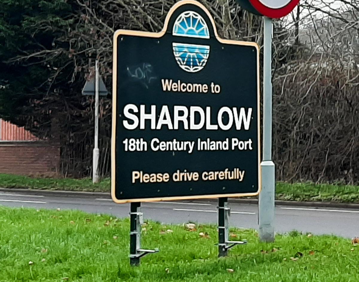
Yet, hidden away in the landlocked heart of the East Midlands, where Derbyshire borders Leicestershire and Nottinghamshire, sits one of the most significant, perfectly preserved transport hubs of the Industrial Revolution: Shardlow.
Shardlow is widely recognized as Britain’s most complete remaining example of an 18th-century canal village.
Boasting over 50 Grade II listed buildings packed into a tight waterfront conservation area, it feels like a living, breathing time capsule.
Here, grand red-brick warehouses, historic coal wharves, and atmospheric pubs stand exactly as they did when horse-drawn barges dominated the water.
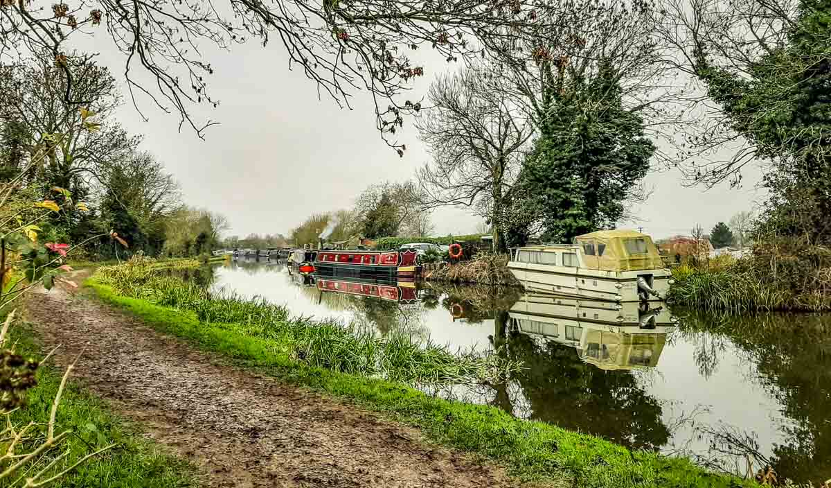
One of the absolute finest ways to experience this area is on foot. Affectionately known in our family as the “Walk of Many Bridges,” a flat, gentle stroll along the Trent & Mersey Canal towpath from nearby Sawley to Shardlow Wharf effortlessly blends spectacular river dynamics with deep industrial heritage.
Here is your definitive guide to exploring this historic waterway trail.
🗺️ Shardlow Towpath Walk & Logistics
The Route:
A linear towpath walk starting at Sawley Marina, tracking the Trent & Mersey Canal westward into the heart of Shardlow Wharf.
Distance:
3.5 miles (5.6 km) one-way, or a highly rewarding 7-mile (11.2 km) out-and-back day trip.
Time Needed:
1.5 hours one-way, leaving plenty of extra time to explore the old wharves and historic pubs.
Terrain & Accessibility:
Exceptionally flat. The canal towpath is well-surfaced, wide, and highly accessible for pushchairs, casual strollers, and cyclists.
Parking & Trailheads:
For the full walk, park at Sawley Marina (NG10 3AE). Alternatively, for a shorter, village-only history stroll, use the free municipal Wilne Lane Car Park in Shardlow (DE72 2HA).
Dog-Friendly:
Yes, it is a brilliant flat run for dogs, but keep them under close control around active canal locks, narrow bridge arches, and nesting waterfowl.
The Meeting of Waters: Sawley to Derwent Mouth
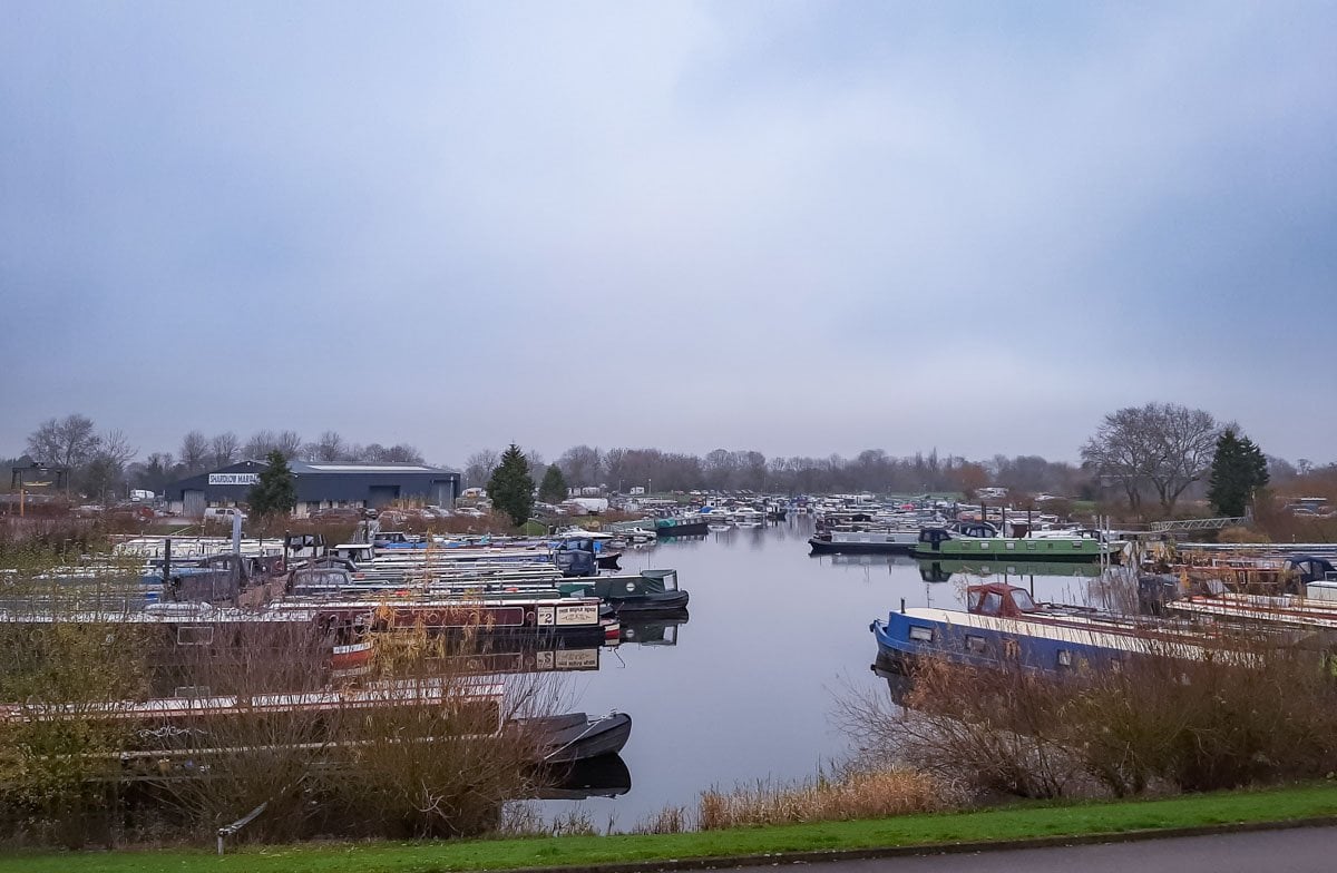
The journey begins at Sawley Marina, a bustling modern hub for narrowboats.
Heading westward, you quickly leave the modern boats behind as you step onto the tranquil path where the River Trent splits away from the artificial canal cut.
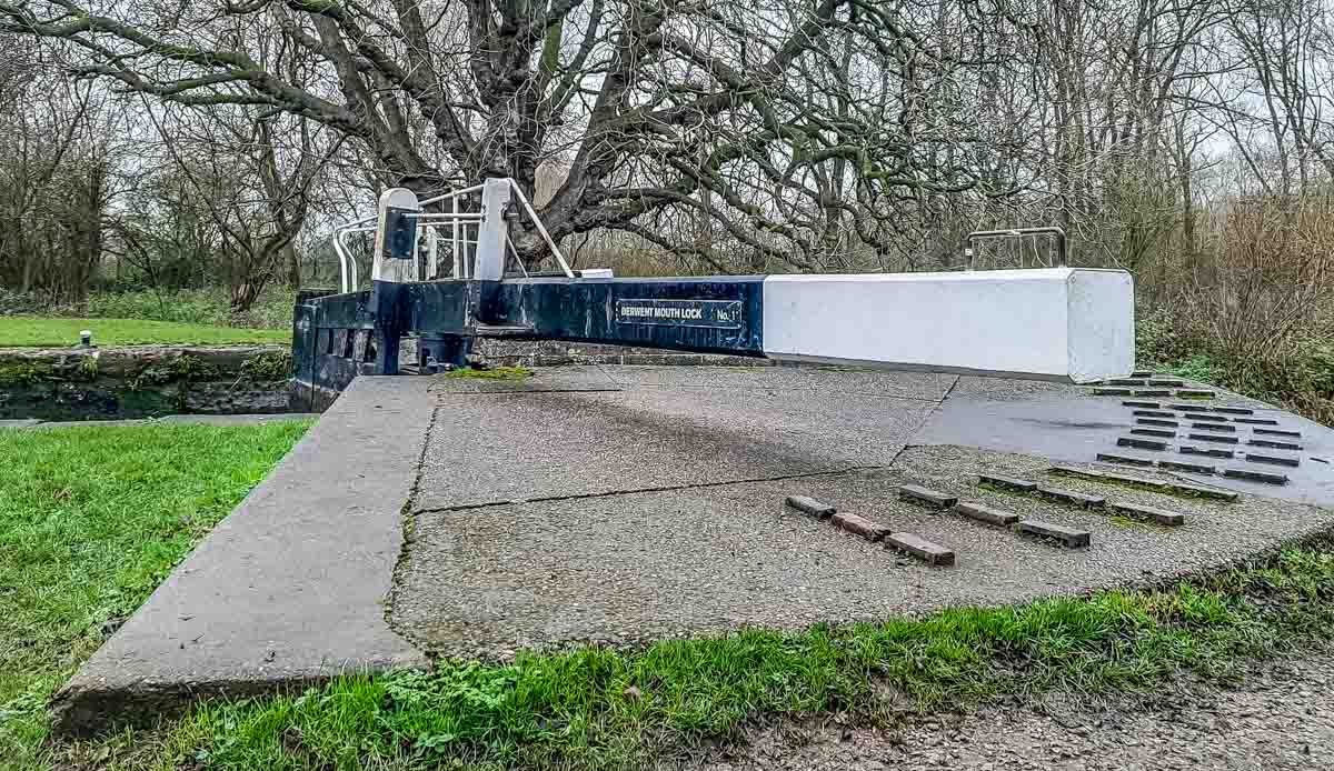
About a mile into the walk, you reach a fascinating, highly strategic aquatic crossroads known as Derwent Mouth.
This is the exact geographical point where the fast-flowing River Derwent empties into the River Trent, and it marks the official birthplace of the Trent & Mersey Canal.
Back in the day, commercial barge horses towing heavy loads faced a massive logistical nightmare here: they needed a way to cross the wide River Trent to continue along the towpath.
This problem led to the construction of Long Horse Bridge.
The original bridge was a slender wooden structure that met a dramatic end in 1893. Following a sudden, savage winter thaw, massive blocks of ice surged down the river, shattering the wooden support legs.
A local bargee named James Thompson tried desperately to defend the bridge, only to be swept downstream on an ice floe in a terrifyingly close call, miraculously scrambling ashore unharmed.
The bridge was rebuilt in concrete in 1932, but after degrading, it was demolished in 2003—a closure that abruptly halted many of our family bike rides for nearly a decade.
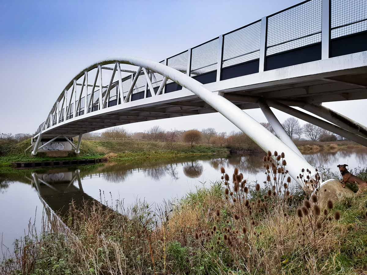
Today, you will cross a magnificent, £1.4 million bowstring arch bridge installed in 2011, a 60-tonne work of modern engineering built to withstand whatever the elements throw at it.
Ancient Soil: From the Bronze Age to the Civil War
As you approach the outskirts of Shardlow, you are walking over a landscape with over 3,500 years of transport history.
The village was originally recorded as Serdelau in the Domesday Book of 1086, translating to “a settlement near a notched mound.”
- If you are interested in the names of our towns, villages and cities then read our guide to how English places got their name.
The area’s identity as a trade route stretches back significantly further.
In 1999, quarry workers at the nearby Hanson gravel pit unearthed the sensational Hanson Log Boat—a 12-foot-long Bronze Age vessel dating back to 1300 BC, found with a cargo of sandstone cargo still intact inside.
A few years later, a bronze sword was discovered vertically embedded in the same quarry gravel. Both are now housed as premier treasures in the Derby Museum and Art Gallery.
By the 17th and 18th centuries, this strategic location allowed the local industrialist Leonard Fosbrooke to control the packhorse routes and river tariffs, accumulating a massive fortune that funded the construction of Shardlow Hall and turned the village into a heavily contested strategic prize during the English Civil War.
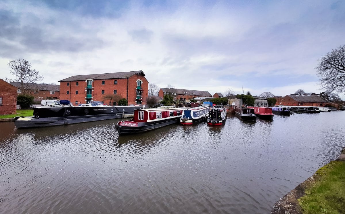
Stepping into the Port: Shardlow Wharf
Passing beneath the final canal brick arches, the landscape expands into the breathtaking historic core of Shardlow Wharf.
When the canal opened in 1777, Shardlow instantly transformed into a booming, chaotic transshipment port.
Because the River Trent downstream could handle large, wide-beam river barges, but the interior canal could only accommodate 7-foot-wide narrowboats, every single ounce of cargo—corn, coal, iron, pottery, and salt—had to be physically unloaded and re-packed here.
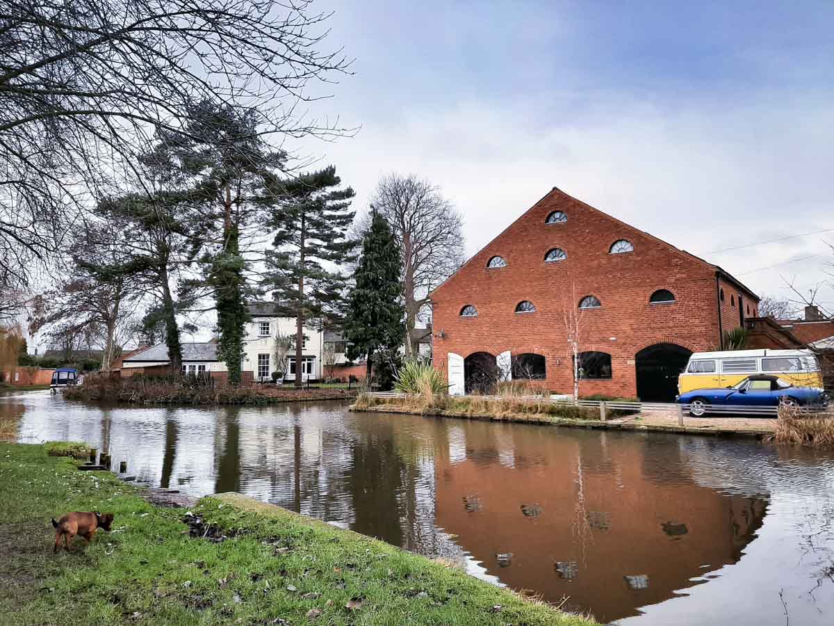
The result was the construction of a grand, architectural wonderland.
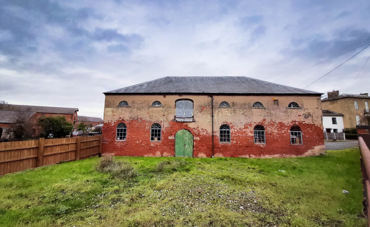
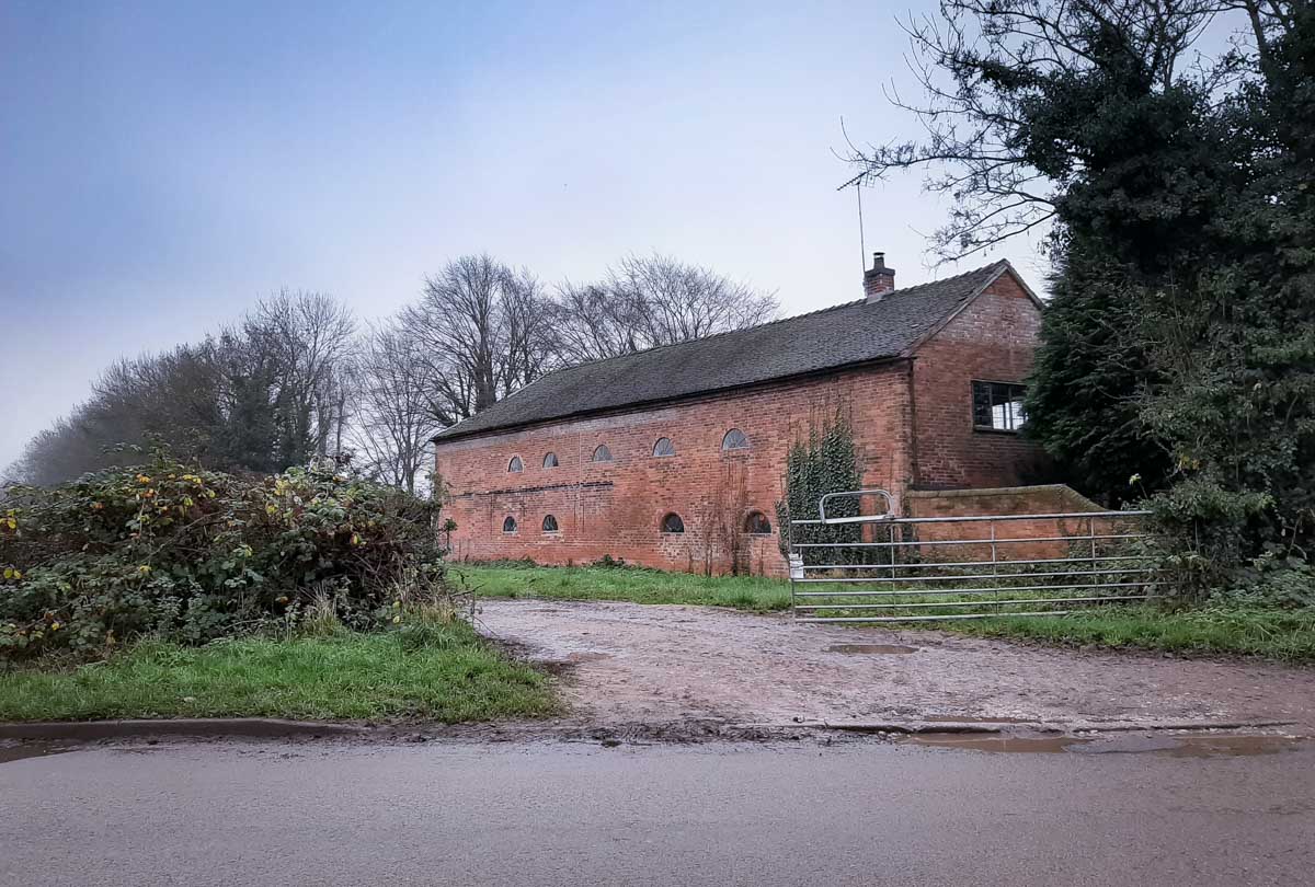
The defining landmark is The Clock Warehouse, a stunning 1780 red-brick mill featuring a massive internal archway that allowed narrowboats to float right inside the building to be loaded from the floors above.
The Historic Canalside Pubs & Fuel Stops
To handle the hundreds of thirsty boatmen, loaders, and merchants who packed the wharves 24/7, Shardlow became packed with historic public houses, many of which still retain their original 18th-century features today:
The Dog and Duck: Located inside the designated Conservation Area, this is recognized as one of the absolute oldest original buildings in the village, perfect for a traditional cask ale.
The Malt Shovel & The Navigation Inn: Classic waterfront stops boasting beautiful beer gardens that look right onto the passing narrowboats.
The Red Door Café at Holden House: If you want a fantastic daytime pitstop, look for Holden House sitting right on the canal bank (1-3 Canal Bank, DE72 2GL).
Their family-run takeaway window serves freshly made cobs, hot soups, and an absolutely mouth-watering array of home-baked cakes.
Pull up a seat by the water, grab a coffee and a slice of their famous blueberry cake, and watch the locks in action.
Cavendish Bridge and the Old Turnpike
Before looping back to your starting point, it is well worth taking a short detour to view Cavendish Bridge.
Long before the modern A6 and A50 dual carriageways bypassed the village, this bridge carried the main, bustling London-to-Manchester turnpike road over the Trent.
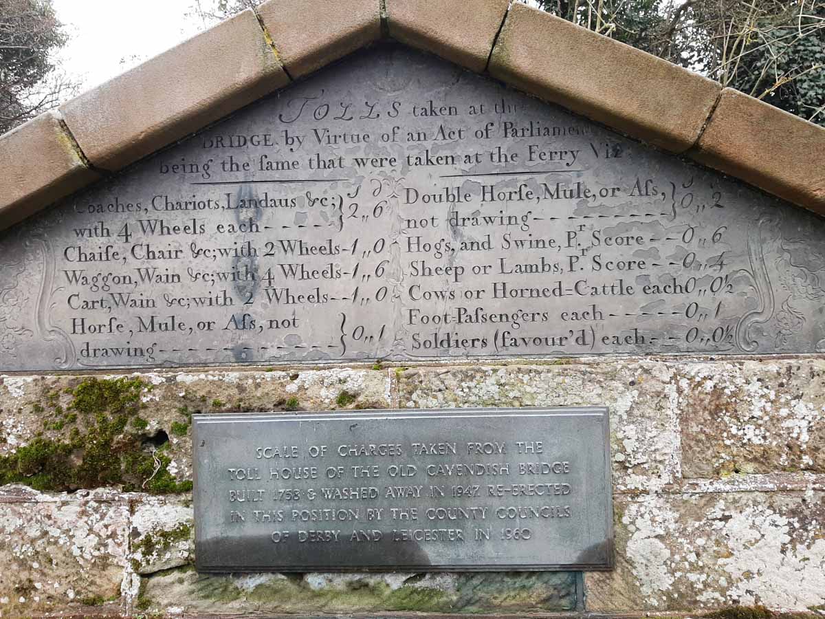
Originally the site of the ancient “Wilden Ferry,” a beautiful five-arch stone bridge designed by James Paine opened here in 1760, named after its wealthy patron, William Cavendish.
A remnant of the old stone toll house still stands today, complete with a beautifully preserved plaque displaying the original 1760 toll tariffs—charging heavily for elegant four-wheeled chariots and landaus, while allowing foot soldiers to cross completely free of charge.
Like its wooden neighbor upstream, the masonry bridge was ultimately destroyed by massive regional flooding in 1947, leading to the concrete span we use today.
Shardlow is a rare triumph of heritage preservation.
It proves that you don’t need to climb a mountain peak or explore a rugged coastline to find a dramatic landscape; sometimes, a peaceful walk along an old towpath can unlock centuries of human grit, engineering genius, and timeless storytelling.
Explore More Spectacular East Midlands Heritage & Canalside Walks
- The Industrial Giant: A Walk Beside and Over Bennerley Viaduct in the Erewash Valley
- The Peak Rail Trail: Millers Dale on the River Wye – A Relaxed Monsal Trail Walk
- The Hidden Fortress: Bolsover Castle: A Walker’s Guide to Derbyshire’s Storybook Setting


