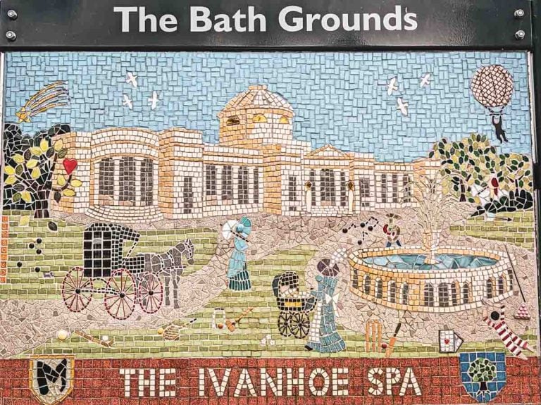
Introduction: The Rooftop of Leicestershire
In the heart of the English Midlands, a landscape better known for its gentle undulations than for dramatic peaks, stands a hill of remarkable character and profound contradictions.
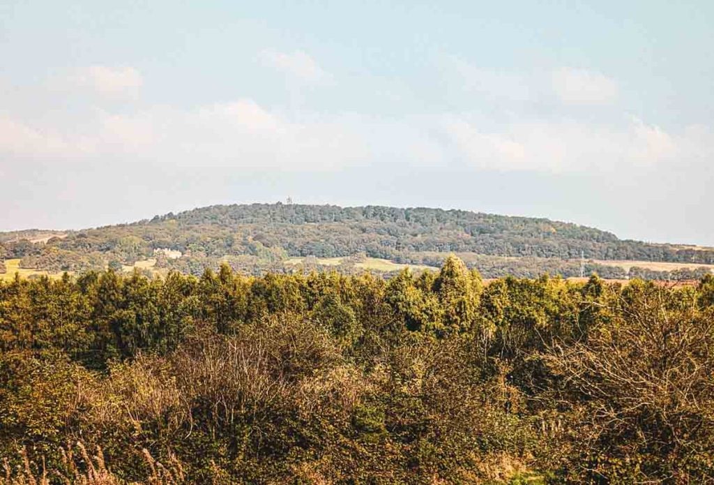
At 278 metres (912 feet) above sea level, Bardon Hill is the highest point in the county of Leicestershire, a rugged outcrop in the ancient Charnwood Forest that commands the skyline for miles around.
In fact this hill features in our Leicestershire 3 Peaks Guided Walk which people love to come along to.
To stand on its summit is to stand on the rooftop of the county, with a view that has captivated writers, royalty, and scientists for centuries.
Yet, the story of Bardon Hill is one of a dramatic and inescapable duality. It is a place where deep time confronts modern industry with breathtaking immediacy.
One face of the hill is a protected Site of Special Scientific Interest (SSSI), a precious remnant of primeval woodland and heath that serves as a sanctuary for rare wildlife and a window into a geological past stretching back 600 million years.
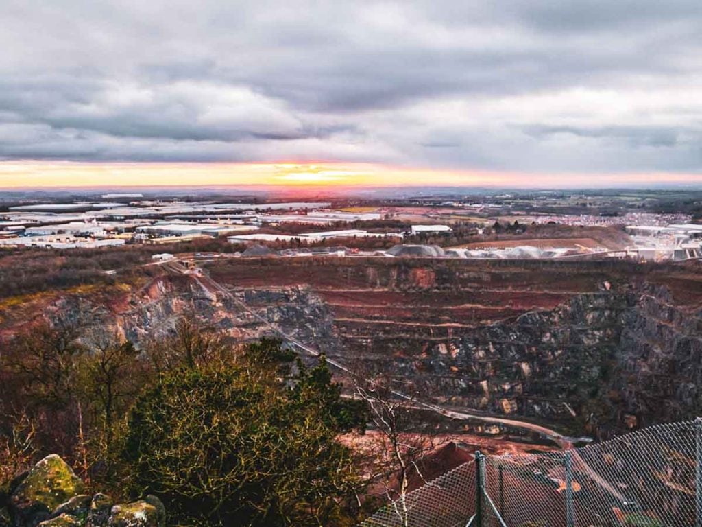
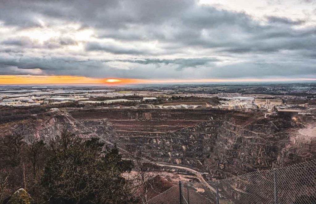
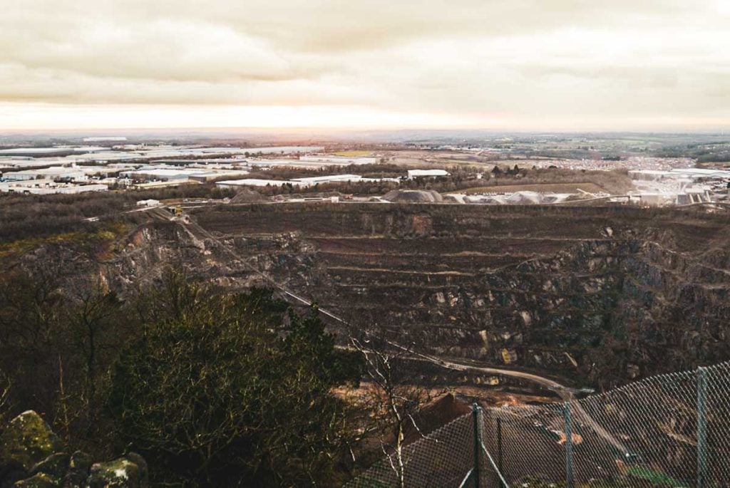
The other face has been systematically carved away to create the Bardon Hill Quarry, a colossal amphitheatre of industrial extraction and one of the largest and most important sources of quarried stone in the United Kingdom.
This visual and thematic tension is the essence of the Bardon Hill experience; it is not merely a hill with a quarry beside it, but a landscape whose identity is forged from the interplay between preservation and consumption.
This guide delves into every layer of that complex identity.
It is a journey back to the hill’s origins as a Precambrian volcano, through its time as a medieval deer park and a secret haven for religious rebels, to a memorable picnic spot for a Queen Dowager.
It explores the whispers of folklore that connect it to the last bears of Leicestershire and even, speculatively, to the foundational British myth of King Arthur.
By understanding the full, rich, and often paradoxical story of Bardon Hill, a modern-day hike to its summit is transformed from a simple walk into a deeply meaningful exploration of the forces—geological, historical, and industrial—that have shaped the English landscape.
Forged in Precambrian Fire: The Geological Story of Bardon Hill
The ground beneath a hiker’s feet on Bardon Hill is profoundly ancient.
This is not mere soil and rock, but the eroded heart of an immense volcano that erupted in the dim recesses of the Precambrian era, approximately 570 to 600 million years ago.
This staggering age places its formation in a time before the dinosaurs, before the first complex life crawled onto land, making its rocks some of the oldest exposed anywhere in England.
The Charnian Supergroup
Bardon Hill is a prominent feature of the Charnian Supergroup, a thick sequence of volcanic and sedimentary rocks that form the rugged uplands of Charnwood Forest.
The geological consensus is that these rocks did not form on a continental landmass but originated in a deep-sea environment.
The Charnian landscape was once an arc of volcanic islands, similar to the modern-day island of Montserrat in the Caribbean, set within a vast ocean.
The rocks that comprise Bardon Hill are therefore described as “volcaniclastic”—a mixture of ash, dust, and larger rock fragments that were violently ejected from these volcanoes and settled through the water to form deep layers on the seabed.
The specific rock at Bardon Hill belongs to the Maplewell Group of this sequence and is a type of andesitic breccia, a hard, durable stone prized by the quarry and known commercially as ‘Bardon Good Rock’.
This is distinct from the intrusive igneous diorites, known locally as ‘markfieldite’, which formed from molten rock cooling deep underground and are quarried elsewhere in Charnwood Forest.
Global Significance and a Buried Landscape
The global importance of Charnwood’s geology was cemented in 1957 with the discovery of Charnia masoni in a nearby quarry.
This frond-like organism was one of the first complex, multi-cellular Precambrian fossils ever identified, providing a crucial glimpse of life before the “Cambrian Explosion” of biodiversity.
While not found on Bardon Hill itself, this find underscores the international significance of the rock strata a visitor walks upon.
The very act of quarrying, which consumes the hill, has paradoxically provided the clearest view into its deep history.
The quarry face offers a spectacular geological cross-section, revealing not only the ancient Precambrian rock but also how it was later shaped.
The south-west face of the quarry exposes a superb example of an exhumed Triassic landscape: a V-shaped valley, carved into the hard volcanic rock during the Permian period over a quarter of a billion years ago, was subsequently buried and filled with the red desert sandstones of the Triassic era, around 230 million years ago.
The hike up Bardon Hill is therefore a physical journey through geological time, and the quarry provides an astonishing, open-page textbook on this immense history.
A Walk Through Time: From Royal Picnics to Religious Rebels
Layered upon the ancient volcanic rock is a rich and fascinating human history, which saw Bardon Hill transform from a private aristocratic playground into a sanctuary for religious and political dissent.
The hill’s story is one of seclusion, a quality that has served vastly different purposes through the centuries.
The Medieval Deer Park
For much of its recorded history, the hill was the centrepiece of Bardon Park, an ancient deer park with documentary evidence of its existence as early as 1270.
As part of the extensive Manor of Whitwick, the park covered some 1,200 acres and was enclosed by an earth bank topped with a wooden fence, a landscape designed for the exclusive leisure of the nobility.
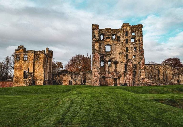
Within this enclosure, in a shallow valley south of the hill, stood the original Bardon Hall, a moated house that was home to the Hood family from the reign of Henry VIII for around 300 years.
The legacy of this era endures, as herds of deer can still be found within the historic park’s boundaries today.
A Haven for Dissenters
The very features that defined Bardon Park as a private, enclosed space—its remoteness, the defensive moat of the hall, and the patronage of the landowning Hood family—gave it a new and vital purpose in the 17th century.
Following the 1662 Act of Uniformity, which ejected more than 2,000 non-conforming clergy from the Church of England, the estate became a secret sanctuary.
The old moated hall was a “relatively safe place for meeting” for this “underground” network of dissenters who worshipped according to their conscience rather than the dictates of the King.
The landscape that had once served to keep deer in now served to keep the authorities out.
After the passing of the Act of Toleration in 1689, this freedom was made permanent when John Hood of Bardon Hall built a meetinghouse, the Bardon Park Chapel, at the gate of his estate around 1694.
This chapel, later altered in 1877, still stands and contains a unique architectural quirk: a “coffin window” was installed in 1926 specifically to help negotiate the tight right-angled turns that the 19th-century alterations had created for pallbearers.
A Queen’s Picnic
In the 19th century, the hill’s reputation as a place of outstanding natural beauty brought it a touch of royal glamour.
In 1840, it was chosen as the location for a picnic for Queen Adelaide, the Queen Dowager and widow of King William IV.
A contemporary account by T.R. Potter describes how the Queen ascended the steep hill with “great apparent ease” and spent over an hour admiring the “wonderful prospect”.
In a charming historical anecdote, the Queen’s repast was first laid out in the sun, but Her Majesty, finding it oppressive, “took up the first dish” herself and led the party to a shadier spot.
This location has since been known as “Adelaide’s Bower,” a lasting memory of a monarch’s visit, even though the bower itself has long since vanished.
Long before this recorded history, the hill was known to earlier inhabitants, evidenced by archaeological discoveries of polished stone axes and bronze spearheads in the area, hinting at a human presence stretching back thousands of years.
A tangible link to this deep past was discovered in a wall at Kellam’s Farm, east of the modern quarry, where a Bronze Age axe head fashioned from local Bardon stone was found.
The View from the Top: Surveying a Quarter of England
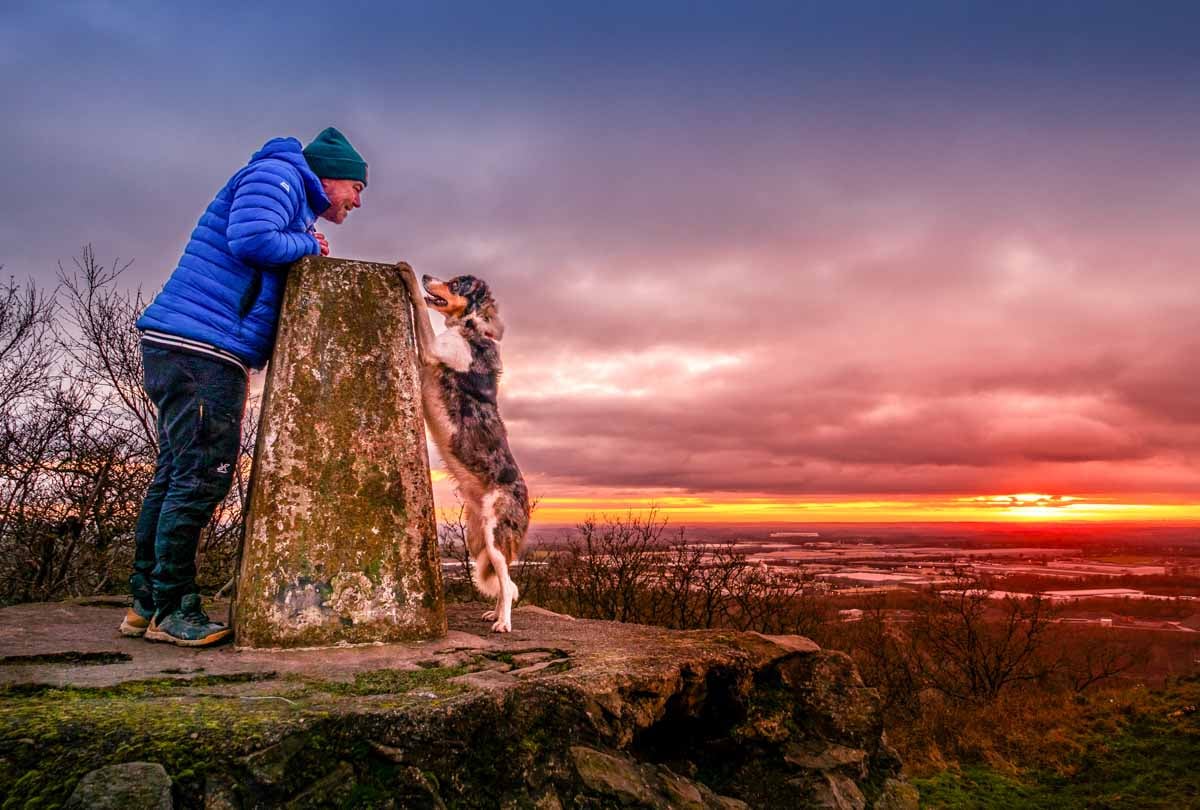
The primary reward for any walker who makes the ascent of Bardon Hill is the view. It is a panorama of such astonishing scale and historical significance that it has long been regarded as one of the most extraordinary viewpoints in Great Britain.
The Legendary Panorama
From the 278-metre summit, the relatively flat topography of the Midlands unfolds into a vast map.
On a clear day, the vista encompasses a staggering sweep of the country. To the west, the distant silhouettes of the Malvern and Shropshire Hills can be discerned, some 50 to 60 miles away.
To the north, the rolling summits of the Derbyshire Peak District are visible, while to the east, the triple towers of Lincoln Cathedral can be spotted, nearly 50 miles distant.
While some claims have stretched credibility—such as the idea that one can see the Sugar Loaf mountain in South Wales, over 90 miles away—the verifiable scope of the view is immense.
This remarkable vantage point captivated 19th-century writers. In the 1830s, John Curtis calculated that the view extended over 5,000 square miles, or “one twelfth of England and Wales”.
His contemporary, T.R. Potter, went even further, claiming that Bardon Hill “probably commands a greater extent of surface than any other point of view on the island” and that an outline drawn from its extremity would “include nearly one-fourth of England and Wales”.
A Point of National Importance
This commanding perspective gave the hill a crucial role in the scientific mapping of the nation. In the 19th century, Bardon Hill was selected as one of the twenty-three principal survey points for the Principal Triangulation of Great Britain.
This monumental undertaking used a network of sightlines between prominent hilltops to create the first highly accurate, trigonometric survey of the country, forming the basis of all modern Ordnance Survey mapping.
The summit was therefore not just a beauty spot, but a vital node in a national scientific project.
The very quality that made the view so celebrated, however, also dictated the transformation of the summit. Its unparalleled prominence and clear line of sight to distant points made it an ideal location for modern communications technology.
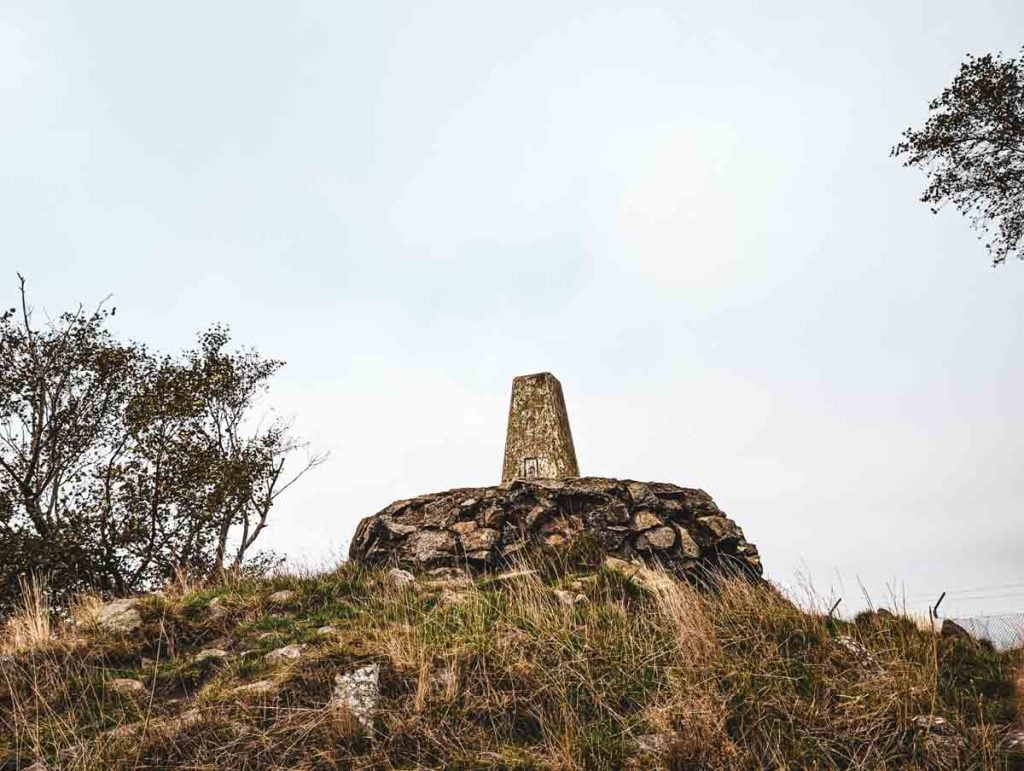
As a result, the historic summit features, including the Summer House and Queen Adelaide’s Bower, have been replaced by two large radio masts.
These structures, now as much a feature of the summit as the ancient rock, provide essential services such as the NOW Leicester DAB radio service, continuing the hill’s legacy as a strategic high point, albeit for a very different purpose.
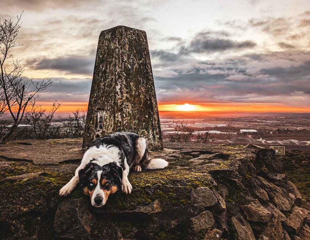
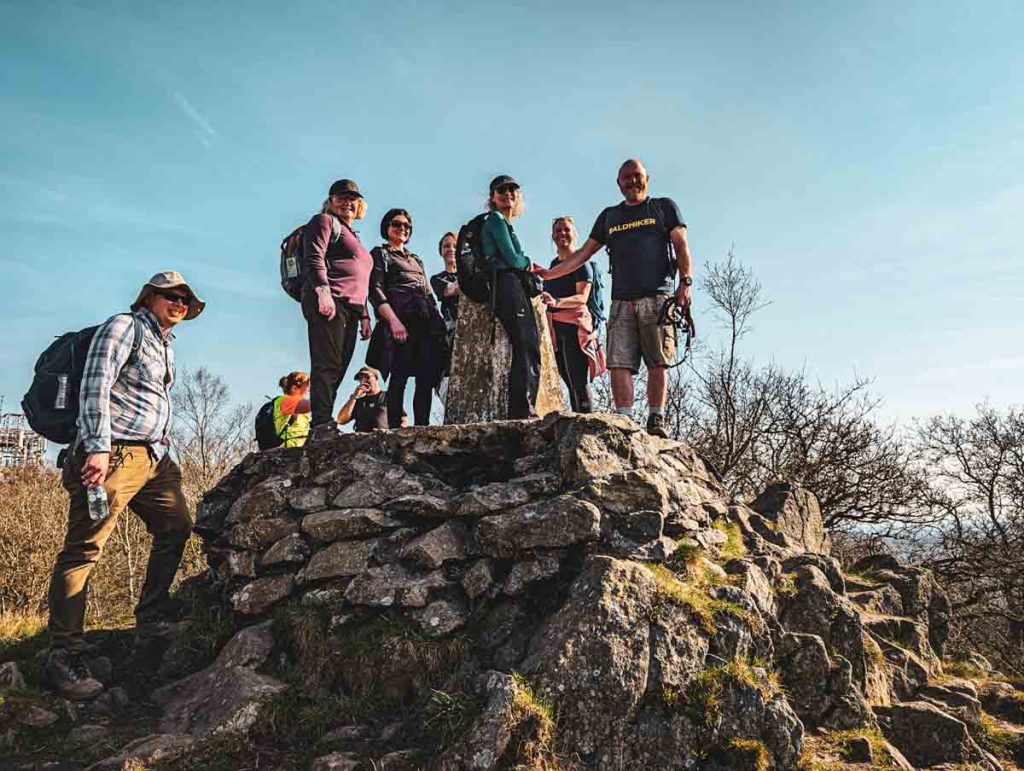
Today’s visitor will find the official summit marked by an Ordnance Survey triangulation pillar, or “trig point,” standing in the shadow of this modern infrastructure.
The Belly of the Beast: The Bardon Hill Quarry
The history of Bardon Hill is inextricably linked with the history of its quarry. This is not a recent development but a 400-year-old industry that has fundamentally shaped the landscape, the local community, and the very infrastructure of modern Britain.
A 400-Year History
The earliest mention of quarrying for granite at Bardon dates to 1622, though for two centuries it remained a small-scale affair.
The catalyst for its transformation into an industrial powerhouse was the 19th century.
The opening of the Leicester and Swannington Railway in 1832, one of the earliest steam railways in the world, provided a means to transport the heavy, durable stone far beyond the local area.
This technological leap coincided with a massive surge in demand. The abolition of the old turnpike road trusts and the passing of Local Government Acts that made councils responsible for road maintenance created a near-insatiable need for hard-wearing roadstone, or aggregate.
By 1890, the quarries of Charnwood Forest, with Bardon Hill at their heart, had become the main source of aggregate for the entire country.
The Nonconformist Connection
A fascinating aspect of this industrial story is its link to the religious history of the hill. The commercial exploitation of the quarry from 1857 was driven by several local nonconformist families, notably the partnership of Ellis and Everard, who leased the quarry lands from the Hood family.
These were the same circles of religious dissenters who had found sanctuary at Bardon Park. Excluded from the traditional avenues of power and influence in Anglican-dominated England, many nonconformists channelled their energies into business and industry.
They became the entrepreneurial drivers of the Industrial Revolution, leveraging new technologies like the railway to build commercial empires.
The story of Bardon Hill is a perfect microcosm of this phenomenon, where the chapel on one side of the estate and the quarry on the other can be seen as two outcomes of the same powerful historical current.
This connection was also expressed in a form of paternalistic capitalism; the quarry owners built cottages and a school in the village of Bardon for their workmen and their families.
Modern Operations and the Future
Today, the quarry is operated by Aggregate Industries, now part of the global materials company Holcim.
It is an operation of immense scale, producing millions of tonnes of crushed rock annually.
This material has been fundamental to some of the UK’s most significant modern construction projects, including the London Olympic Park, Wembley Stadium, and the Silverstone racing circuit.
The site continues to evolve, with a recent major extension project and an upgrade to the railway level crossing ensuring its operation for decades to come.
In response to modern environmental standards, the company has stated a commitment to sustainability and the “circular economy,” promoting the use of recycled materials through its ECOCycle range and has outlined plans to partially infill the exhausted quarry workings and restore the area for nature in the future.
A Sanctuary for Spiders and Skylarks: The Wildlife of Bardon Hill
Despite the immense industrial activity, the unquarried portion of Bardon Hill remains a vital and surprising ecological haven.
Its survival as a rich habitat is a direct consequence of its geology; the same hard, ancient rock that makes the hill a prime target for quarrying also creates poor, acidic soil on its upper slopes, rendering it unsuitable for intensive agriculture.
This historical “unproductiveness” has inadvertently preserved a unique mosaic of habitats that now holds formal protection as a 13.1-hectare biological Site of Special Scientific Interest (SSSI).
A Mosaic of Habitats
A walk up Bardon Hill is a journey through several distinct habitats. The lower slopes are dominated by mature oak woodland, a remnant of the ancient Charnwood Forest.
Higher up, this gives way to areas of conifer plantation, before the summit area opens out into a classic upland mix of heathland, acid grassland, scrubby dwarf oak, and exposed rock outcrops.
It is this varied, marginal landscape that supports the hill’s most important wildlife.
A Magnet for Birds and a Haven for Spiders
Bardon Hill has a well-earned reputation as a “bird magnet,” especially during the spring and autumn migration periods.
The summit acts as a waymarker for passing birds, and it is one of the most reliable sites in the county to see species like the Ring Ouzel and Wheatear.
The healthy population of Skylarks provides a constant soundtrack to a summer walk, while the skies above are often patrolled by resident birds of prey, including Buzzards and Peregrine Falcons.
Ravens and Barn Owls also breed in the wider Bardon Park area.
Perhaps the hill’s most unique ecological claim, however, lies with its smaller residents. It is noted for its remarkable diversity of invertebrates, particularly its spider population.
An incredible 133 species of spider have been recorded on the hill, including the nationally rare Tetrilus macrophthalmus, a tiny money spider found among the rocks and lichens of the summit.
This specific and memorable detail highlights the importance of preserving such “unproductive” landscapes, which often harbour a hidden wealth of biodiversity.
The wider park area also supports populations of mammals including deer, foxes, and badgers.
Myths, Legends, and a Marilyn: The Secrets of the Hill
Beyond its formal classifications as a geological and biological SSSI, Bardon Hill has accumulated a collection of classifications, myths, and legends that give it a cultural stature far greater than its modest physical height.
For many walkers, part of the appeal lies in “bagging” a peak that is not just a high point, but a place rich in story and intrigue.
What is a Marilyn?
Bardon Hill holds the proud status of being a “Marilyn.” This is a popular term in the British pastime of “peak-bagging,” referring to any hill with a relative height—or “prominence”—of at least 150 metres ($492$ ft) on all sides, regardless of its absolute height above sea level.
The name, coined by author Alan Dawson, is a punning contrast to the “Munros” of Scotland (peaks over $3,000$ ft), in reference to Marilyn Monroe.
With a prominence of 172 metres, Bardon Hill qualifies comfortably, placing it on a prestigious list of 176 such hills in England and making it a target for hikers from across the country.
Local Legends and Arthurian Whispers
Like many ancient places, the hill has its own local folklore.
One charming legend claims that a small cave or rock overhang on the hill was the last lair of the last wild bear in Leicestershire, a classic piece of local storytelling that connects the landscape to a wild, untamed past.
More intriguing is the speculative connection to the legend of King Arthur. Bardon Hill is listed among a number of potential sites for the legendary Battle of Badon, or Mons Badonicus.
This was the decisive battle, fought around the turn of the sixth century, where the native Britons are said to have inflicted a crushing defeat on the invading Anglo-Saxons, halting their westward advance for a generation.
While the true location is lost to history and fiercely debated by scholars, the fact that Bardon Hill’s prominence and strategic location have earned it a place on the list of candidates adds a thrilling layer of mythic resonance to any visit.
To stand on the summit is to stand on a place that, however tenuously, is woven into the foundational story of Britain itself.
Your Adventure to the Summit: A Hiker’s Practical Guide
A visit to Bardon Hill offers a rewarding experience for walkers of various abilities. The routes to the summit are generally straightforward, with the main reward being the spectacular panoramic views.
This section provides all the practical information needed to plan your adventure.
Walking Routes Overview
There are several well-trodden paths to the summit, varying in length and starting point. The table below summarises the most popular options.
Bardon Hill Walking Routes at a Glance
|
Route Name / Start Point |
Distance (km/miles) |
Approx. Time |
Difficulty |
Key Features |
|---|---|---|---|---|
|
Warren Hills Road Loop |
3.4 km / 2.1 mi |
1 – 1.5 hours |
Easy-Moderate |
Scenic start, mixed woodland, well-marked trail. The classic choice for first-time visitors. |
|
Coalville Short Route |
3 km / 1.75 mi |
1 hour |
Easy |
Quickest ascent, starts from a residential area in Coalville (off Romans Crescent). Good for a short burst of exercise. |
Featured Route in Detail: The Warren Hills Road Loop
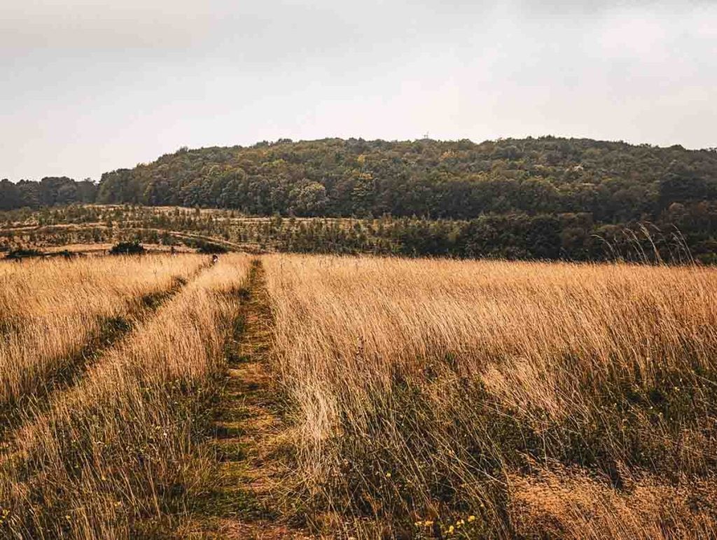
This is arguably the most popular and scenic route to the summit, offering a varied and enjoyable 4.4 km (2.7 mile) circular walk.
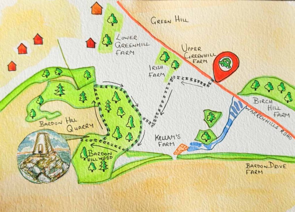
- Start: The route begins from the small parking area off Warren Hills Road (nearest postcode: LE67 9QD).
- Ascent: The path starts with a gentle ascent through pleasant mixed woodland of oak, birch, and beech. After about 1.5 km, a clearing provides the first proper glimpse of Bardon Hill. From here, the path becomes progressively steeper as it makes its way towards the summit trig point.
- Summit: At the top, walkers are rewarded with the famous 360-degree views and a close-up look at the trig point and radio masts.
- Descent: The return journey follows a different path, looping back towards the start. This section is less steep, passing through open heathland and fields, with charming old stone walls and hedgerows adding to the character of the walk before it re-enters the woods for the final stretch back to the car park.
Practical Information
Getting There: For drivers, the main starting points are the car park on Warren Hills Road (LE67 9QD) though parking can be limited. For public transport users, the nearest major town is Coalville, which is served by local bus routes. Some walks can be started from the outskirts of the town.
Difficulty & Terrain: The walks are generally graded from Easy to Moderate. While most paths are clear, they can be uneven, rocky, and muddy in places. The final approach to the summit is steep, and some describe the path around the very top as a “bit of a scramble,” though it is manageable for most reasonably fit walkers.
Best Time to Visit: For the best chance of clear, panoramic views, a visit between late spring and early autumn is recommended. The warmest and driest weather is typically found from July to August. A spring visit offers the added bonus of seeing wildflowers and listening for the songs of migrant birds like the Tree Pipit.
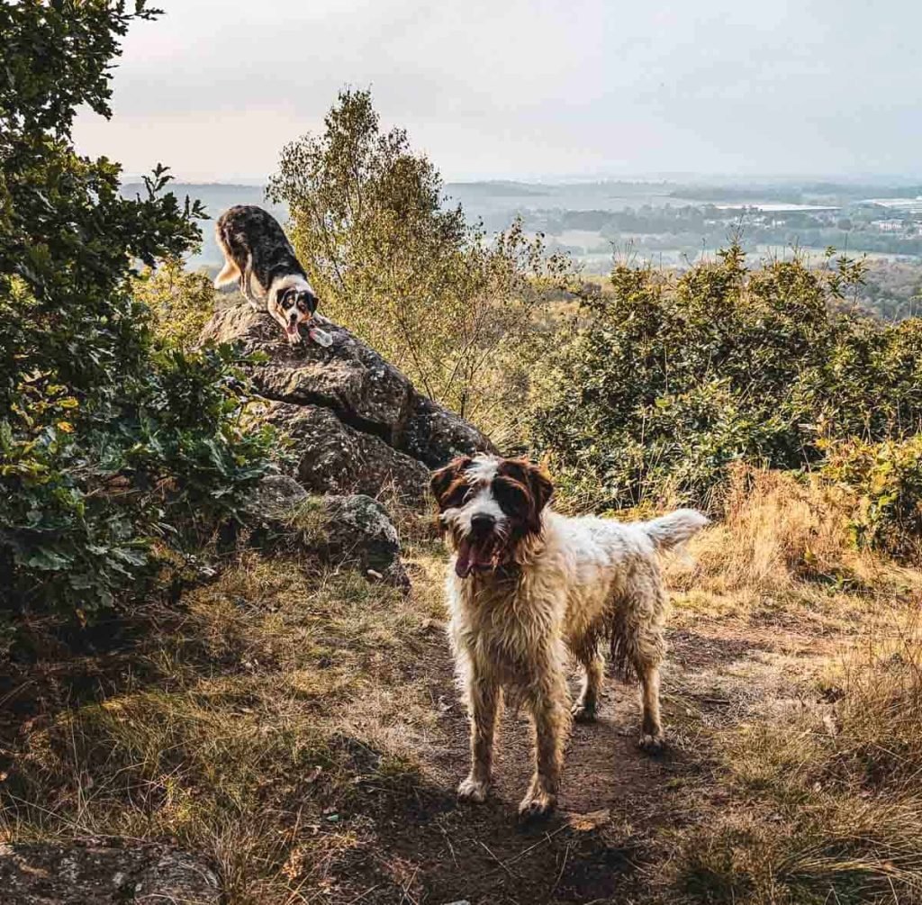
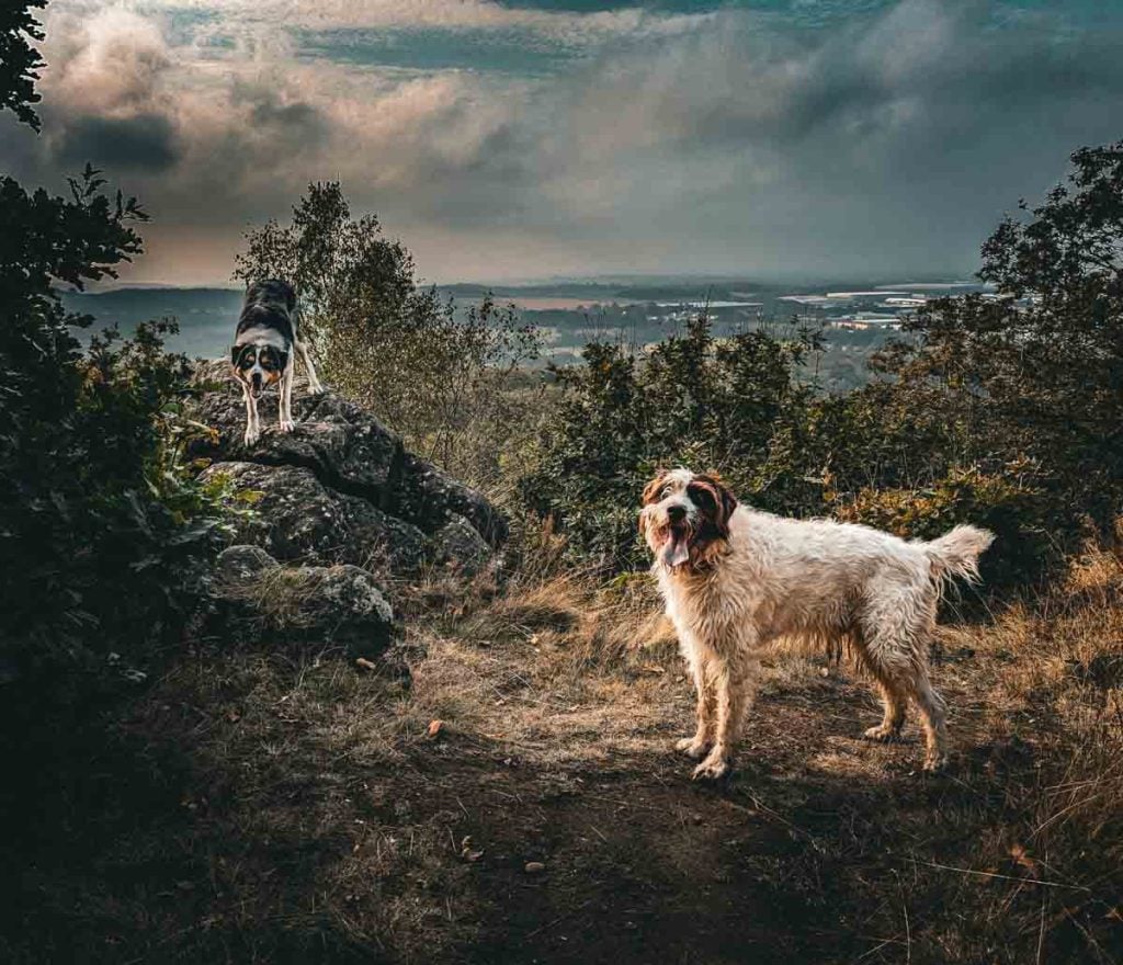
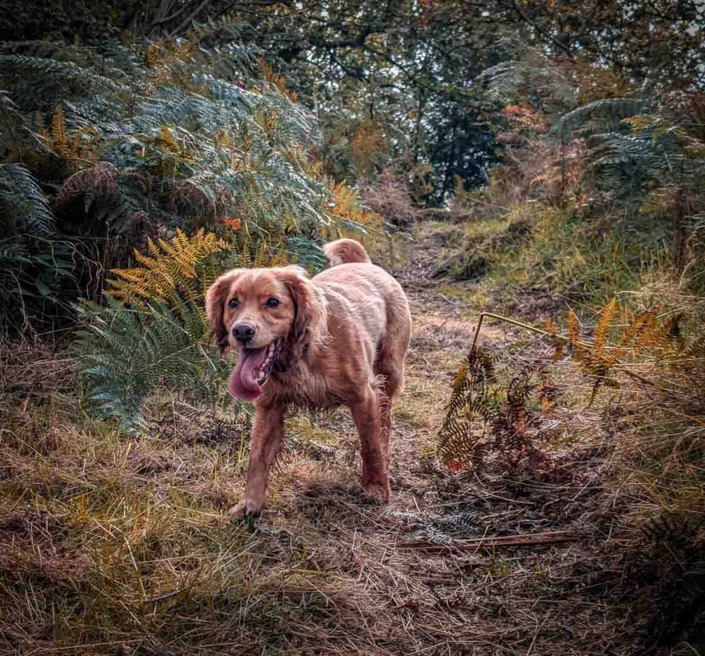
Is it Dog-Friendly? Yes, several organised walks on Bardon Hill are explicitly listed as “dog friendly”. It is a popular spot for dog walkers. However, owners should act responsibly, keeping dogs under control, especially near the steep drops into the quarry and in any areas where livestock may be grazing.
Is it Family-Friendly? The shorter routes are certainly achievable for families with children who have some walking experience. The sense of achievement on reaching the highest point in the county is a great motivator. However, parents should be aware of the steep sections and uneven terrain.
For families with very young children or those requiring pushchair-friendly paths, nearby alternatives such as the surfaced paths at Thornton Reservoir or the flatter areas of Bradgate Park might be more suitable.
We have another walk that is short and also starts on Warren Hill Road, where you can walk amongst the ancient rocks of Warren Hills.
Conclusion: More Than Just Leicestershire’s Highest Point
Bardon Hill is far more than a simple geographical superlative.
To define it merely as the highest point in Leicestershire is to overlook the immense depth and complexity that make it such a compelling destination.
A visit here is a journey through the grand narrative of the English landscape itself, a place where profound, often contradictory, stories are layered upon one another.
It is an ancient volcano, whose fiery birth in the Precambrian era has endowed the region with its rugged character and mineral wealth.
It is a historical landscape, shaped by the aristocratic leisure of a medieval deer park and later repurposed as a secret sanctuary by religious dissenters seeking freedom of conscience.
It is a modern industrial engine, its stone forming the foundations of our cities and transport networks, a process of consumption that continues to reshape the hill daily. It is a fragile ecological refuge, where the marginal land unwanted by farmers has become a vital haven for rare spiders and migratory birds.
And it is a place of myth, a candidate for an Arthurian battlefield and the fabled home of the last bear in the county.
The true reward of a walk up Bardon Hill is the ability to stand at its summit and comprehend these overlapping identities all at once.
The view is not just of the surrounding countryside, but of the immense quarry below—a stark reminder of the tension between preservation and progress.
To climb Bardon Hill is to do more than just bag a peak; it is to engage with a landscape that tells a deep, powerful, and uniquely English story.
It is an invitation to experience this extraordinary and paradoxical piece of the country for oneself.