
Cross Fell’s summit stands at 893 metres (2,930 ft). The highest point along the whole of the Pennines and it is the highest point in England outside the Lake District, albeit still in Cumbria.
It stands high on the eastern flank of the Eden Valley and more than often it is covered in cloud. But when the clouds disappear the summit is there to tempt you up.
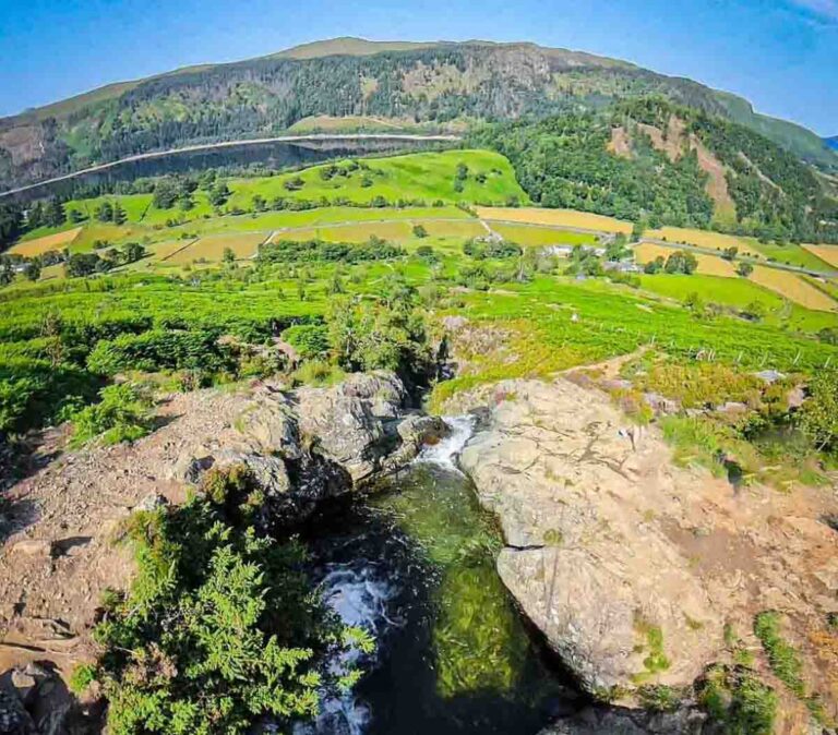
Believe me, it is not just getting up to this massive plateau of a summit but the views across the valley to the mountains of the Lake District too that can make it so special.
This 9 mile circuit up Cross Fell starts and finished in the village of Kirkland in the Eden Valley, Cumbria.
I lived close by at the time when I did this walk this day and it was wintry but gorgeous with blue skies. With only so many hours of daylight it was time to get a move on and get my boots on.

Parking
Parking for this route up is in the village of Kirkland. There is plenty of places to park on the side of the lane through the village, but be careful to respect people’s property and driveways.
The postcode for parking is CA10 1RN
The Climb Up Cross Fell
In the village you will see the church. From the church head up the track that leaves the road and heads towards the Pennines.

As you see the summit of Cross Fell the path will head off and left taking you around High Cap before heading more directly towards the summit.
My heart and lungs were certainly getting a workout in the deep fresh snow. I soon realised I was the first person to walk up here after the fall of snow and was thankful for using a GPX route together with knowledge of the area.

Going up it is never easy not to stop and look back. The vast expanse of the Eden Valley lay out before you. The mountains of the Lake District in full view across the valley with snow covered summits. Blencathra and the Helvellyn range looking bold and handsome as ever in their own wintry beauty.
Ahead lay my goal for today though, and the crisp white ice and snow underfoot looked lovely and stark against the pure blue clear sky.

There is something special about hiking in the winter. The mountains virtually to yourself and clear fresh air.

It was quiet up there, so so quiet. Lovely. The overhang on the summits front ridge lay ahead, brought about by high winds and snow. The ice crystals flickered in the sunlight.
As you near the summit plateau you will reach the Pennine Way. Turn right along it and up towards the summit area.

Cross Fell Summit
The summit plateau of Cross Fell is big, wide and windy. If you have a view count yourself lucky and savour it.
The physical summit is marked by a trig point as well as the wind shelter nearby.

The snow and wind had given this high spot a battering overnight. Snow drifts galore and the cairns full of ice on their stones.

Looking south just a couple of miles from the summit you have the second highest pennine peak, Great Dun Fell.
That peak is unmistakable due to the weather station on its top. Looking like a giant golf ball. From there the ridge leads on to High Cup Nick.

Down below you see the smaller traingular peaks, the volcanic cones that seem to line the foot of the Pennines in line like Dufton Pike and Murton Pike.

Looking north you can see over the Solway Firth, over Dumfries and Galloway and the first hills of Scotland.
Eastwards is the main big view, all the way to the coast but before that comes the wide Eden Valley and the mountains of the Lake District.

Westwards though you see more of the moorland expanse. That way leads to the Durham Dales and Alston etc. You can climb Cross Fell from that side but it is an even longer slog.
Speaking of westwards, the Rivers Tyne, Tees and Wear all start their life and journey up here on Cross Fell.
You really do feel alone and in the middle of Britain.

Heading Back Down
To head back down via the circular, cross the summit directly off the opposite end than you came.
You will come to a crossroad of paths, called Tees Head. Hard to imagine this little spot eventually creates the wide River Tees of Teesdale.
Take a right, downhill at the crossroads and path follows down over Wildboar Scar.

As you near the bottom the path heads right and back towards Kirkland.
I made it down as the sun set and darkness fell. Fully refreshed.

Route Details and GPX
Distance: 9 miles
Time: 4.5 hours
Download the GPX for Cross Fell Circular Walk


Wonderful photos. Slowly making my way up and down the high fells. Hope to do this one soon. Almost 70 years of age, so I’d better hurry.
KW
Go for it 🙂
I was looking out of my window at Cross Fell on Sunday thinking the views would be great in that unusual combination of sun and snow. Parental duties in the morning meant a short walk in the afternoon instead so great to have your photos instead!
was great up there as ever Jill, cheers 😀
Great set of pictures. Would welcome details of camera etc.
Hi Dave, cheers.. Sony Cybershot and iphone 4s
Awesome photos!
Thank you very much