The 12 day Annapurna Circuit trek in Nepal is considered one of the best long-distance treks in the world. The Annapurna Circuit while at times pretty tough thank you very much, is stunningly beautiful, and an adventure which I guarantee will leave you forever changed.

The task of trying to disseminate my full Annapurna Diary into this blog has been pretty tough too though! There is just so much to share, therefore my blog appears in 3 parts: Part I is Kathmandu to the Bhratang Apple Orchards, Part II sees us leaving Bhratang with apple pie in our tummies and ending in Letdar, and Part III is the trek over the mighty Thorang La Pass and the return to Kathmandu. I do hope you will stick with me on the journey, hey and in this time of self-isolation what else do you have to do? So, sit back, put your feet up and relax, and come with me to Nepal…

As the name suggests, the AC trek is a circuit around the Annapurna Himal, a mountain range in Central Nepal, to the west of Kathmandu, which is home to some of the mightiest mountains in the world, Annapurna I / Main at 8,091m, 5 other peaks over 7,000m, and then numerous 5,000 and 6,000ers. A Maori proverb says ‘if you should bow your head, be it to a lofty mountain’, well there are plenty to bow to on the AC trek.
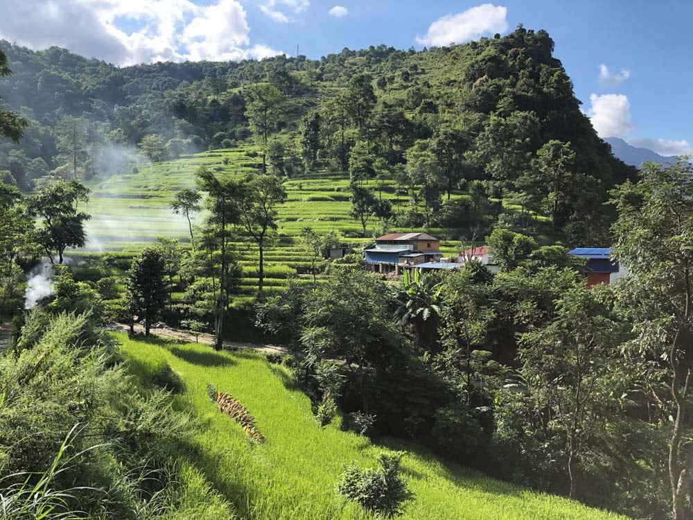
On the trek you will experience a little slice of everything that fabulous Nepal has to offer from an immense variety of spectacular scenery, the richness and diversity of Nepalese culture, generous and warm hospitality, to picturesque farming villages, Buddhist temples, iconic colourful prayer flags, jingling mule trains, delicious food (including amazing apple pie), and of course those massive, snow covered mountains.
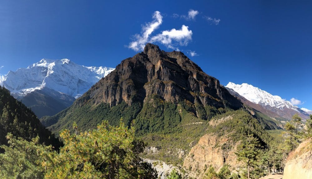
After Chame (day 5) the mountains of the Annapurna Massif dominate your views for the remainder of the trek as you walk in the shadows of these Himalaya giants.

It is one of the few trekkable places on earth where you can experience almost all climatic zones in such a short geographical distance from the lush sub-tropics of the Himalayan foothills and rice paddy amphitheatres near Besisahar, to temperate rhododendron and birch forests, through to pine and fir forests, and climbing up ever higher to more barren alpine climes beyond Manang, and then into the arctic zone over one of the world’s highest trekkable passes, the Thorang La at 5,416m which borders the Tibetan Plateau.
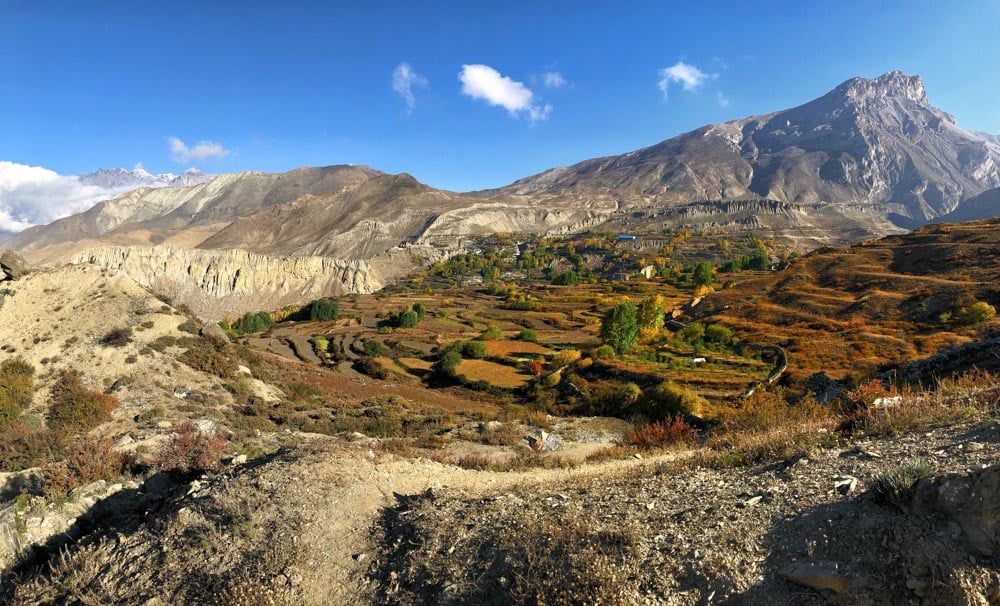
The trek then descends into the semi-arid desert of the Mustang region, ending in windy, dusty but no less spectacular Jomsom, and now routinely ending with a hair-raising mountain flight over the Annapurnas to Pokhara, and then on back to Kathmandu.

Part I: Kathmandu to the Bhratang Apple Orchards
So back on 04 October 2019, my pal Amy and I arrived in Kathmandu to a tropical 27 degrees centigrade and seriously wondered if we had packed too much cold weather gear, so naïve!
We were met by our smiling, Kandoo guide Phurpu who, after draping Khata, traditional silk scarves, around our necks, posed with us for one of many of what we came to refer to as ‘proof of life’ photos.
We then hopped into our transport to the Mulberry Hotel, weaving our way through the colourful, bustling and dusty roads of Kathmandu, the traffic some kind of organised chaos.

At our pre-trek briefing that evening in the hotel garden, over a refreshing mango juice, we met our fellow and only other trekker, Miguel who hailed from Bogota, Colombia (so no stranger to altitude).
It turned out that there would be only the 3 of us on the trek, along with Phurpu and our two porters, Ox and Army who we were to meet up with the next day. However, this meant that we became a very tightly bonded little group. I really miss that mountain family!

We had a 6:30am start the next day and with packed breakfast boxes under our arms we piled into the jeep for the long, hair-raising and at times bone-jarring drive to Besisahar and the start of the trek to Bhulebhule.
However, what we had not counted on was that we had arrived in Kathmandu at the beginning of the Dashain Festival, a major festival in Nepal when people travel back to their homelands, and so there was an exodus it seemed of every man, woman, child, goat, and chicken from Kathmandu as we were also leaving and so the journey took longer than expected.
This meant that we did not have time to do the scheduled trek for that afternoon from Besisahar to Bhulbhule. We picked up Ox and Army, completing our little mountain family, and another vehicle in Besisahar, and travelling along the Marshyangdi River Valley as it turns out we went a bit past Bhulbhule to Ngadi.

We arrived at Ngadi and our first tea house, the colourful Suman Hotel & Restaurant situated on a terrace right above the Marshyangdi River.

We were pleasantly surprised by the basic but quite pretty rooms situated in lovely gardens with a papaya tree, hibiscus and all manner of other pretty Nepalese flowers including these magenta balls which I was later to establish are called Gomphrena which is a globe amaranth.

There was a western toilet (whohoo!) and the promise of a warm shower (it wasn’t really that warm but did the trick), and WiFi! We settled in and then adjourned fairly quickly to the best seat in the house, a lovely table and benches under an awning, amongst the lush foliage dominated by lovely shrubs of Brugmansia aka Angel’s Trumpets and overlooking the roaring river.
We chatted and snacked on popcorn washed down with local, Gurkha beer.

The guys brought us the menu and thus started what would be our end of day routine for the next 2 weeks. We chose our dinner, chatted, we ate, then had our briefing and health check (to include pulse and O2 readings) and then were presented with the menus again to choose our breakfast.
The coming days were to revolve around food! Awesome! And Ox and Army would filter our water morning and evening, as you cannot drink the tap water in Nepal, and we wished to avoid buying bottled water.

We had our first Dahl Baht for dinner which is the traditional meal for Nepalese and all our guys ate, except where supplemented with the food we often shared with them because the meal portions were so plentiful, we often could not eat everything.

Anyway, Dahl Baht is this wonderful mixed platter with steamed rice, a bowl of dahl (lentil soup), some meat or veg curry, pickles, and mix veggies (normally what is in season), and which is in fact ‘all you can eat’ if you so wish.
The Nepalese call this ‘Dal Baht Power 24 hour” or ‘mountain power’ and so we figured this would be an eating habit to copy in order to get us up the mighty Thorong La!

The next morning, ahead of what turned out to be a long and hot 21km trek, we risked the coffee at breakfast but it was as awful as the one we had tried on a rest break the day before and so we decided henceforth to do without.
We were instead to sample the variety of wonderful teas on offer, my favourites ended up being the sweet Masala Tea and the Ginger Tea, the latter often stuffed with fresh ginger.

Shortly on leaving Ngadi we encountered a large landslide covering the track and which was worryingly wet and fresh looking, caused no doubt by recent Monsoon rains. It was a bit scary to contemplate too much as we scrambled over it.
We had to be vigilant and Phurpu would often indicate when we were not to tarry in certain places on the trek. Phurpu warned us that some parts of the ‘old track’ might not be passable due to slips, he’d gather local intel along the way in order to decide whether we’d be going onto the old track or sticking to the road.
Fortunately, we were able to use the old, more challenging and visually stunning tracks more often than not.
At this altitude everything was so lush and the air was a cacophony of a some creature which Phurpu described as ‘like a butterfly’, so I can only assume was some kind of cicada. It was almost deafening and sounded very mechanical rather than something natural, like an unoiled fan belt.
Sadly, I never spied any in order to get a photo.
There were wildflowers galore along the path, including orchids, hibiscus and moss and lichen covered rocks. There was a layer of rock along the trail which had a huge mica content, with the result that the track was glittering all the way and gave a fairy dusting to our boots and trouser bottoms, it was quite magical.
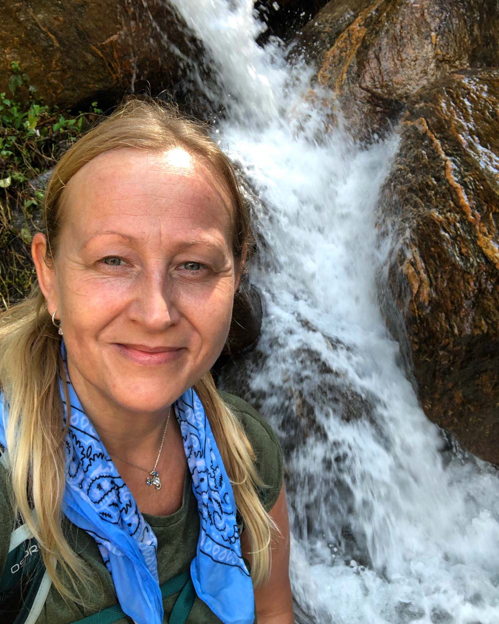
Numerous waterfalls along the way were welcome relief from the heat and I’d wet my handkerchief at every opportunity to either cool my neck or drape over my head.

Following lunch at Ghermu (1140m) overlooking the spectacular Syange Falls, the trek took us over one of the many suspension bridges criss-crossing the roaring Marshyangdi.
A threesome of cute Nepalese kids passed us on the bridge saying melodious ‘Namastes’ as they went.

Namaste is a common Hindu greeting accompanied by praying hands gesture and bow as a sign of respect and which seems to mean hello, goodbye and thank you. It’s literal meaning is something like ‘ I see the light in you / I worship the light/divine in you’, what an absolutely beautiful way to greet a person!

We ascended further and as the valley narrowed into a steep gorge the track led us into the colourful, hot spring village of Jagat and at an altitude of 1,300m we were now back at the same altitude as Kathmandu.
It was a welcome relief to reach there after a very long day, as was the truly very hot 42 degree shower! The only one for the whole trek! All others although touted as hot, were not, and were either cold or lukewarm at best. We were to have few showers after Jagat as it turned out.

The next day’s trek to Bagarchap was long and hot but another stunning and lush one in the sub tropics, with more spectacular waterfalls, wildflowers, wild cucumber, lizards basking on rocks or hiding in the vegetation, heart stopping cliff edges and suspension bridges.
Almost all the flora that I stopped and asked Phurpu about was met with the response, ‘used as medicine’, and certainly as we passed through villages all along the AC we noticed the harvesting of a variety of plants either being cultivated in plots or just growing wild along the way-side, and often what would probably have been dismissed by us as weeds.
You get the sense that everything is utilised, and I have since read that a vast lore of medicinal herbs is still in use in Nepal, as indeed in many indigenous cultures.

Apparently, Nepal has 600 indigenous plants with recognised therapeutic purposes, more than half of which occur in the sub-tropical zone and this includes a large number of the lichens.
Lichens, of which there are apparently some 352 species, are also used in perfume and some have antibiotic properties. There are also over 350 species of Fern which are used for medicinal purposes and eaten.
I was also to discover that day, after a massive energy slump after 4 plus hours trekking, that I needed to be ordering more at breakfast, and to include a carb source, as trekking on a one egg omelette and a cup of tea until lunch time was just not going to cut it!

On the approach to Bagarchap (2,160m), there was a stark reminder as to why one needs to stick to the mountainside of the track, as I was barged rather unceremoniously into it as I tried to video a passing, jingling mule train laden with all sorts, even gas cylinders and which seemed to make a bee line for me.
Phurpu said that they were carrying gear down from the Manaslu exhibitions as the climbing season had now finished.

The following morning on leaving Bagarchap we got our first view of the mighty Manaslu, a proper Himal and one of the 8 thousanders no less. Manaslu which means ‘mountain of spirit’ stands at 8,163m and is the 8th highest mountain in the world, and provides a stunning back drop to Bagarchap, albeit this morning a cloud cap covered the summit.

Entering the Manang Valley, there was a distinct cooling of the climate and vegetation change as we started climbing through rhododendron, pine and fir forests and we started to see lots of different fungus too.
We encountered a small roadside vendor displaying a far too tempting array of jewellery and trinkets and after our purchases we then climbed on passing lots of stone chortens and some very picturesque scenes of rural life including a very jolly looking tractor adorned with prayer flags, drying corn, lots of goats, buffalo, and typical Tibetan stone houses with flat rooves stacked with firewood.

We passed a wonderful, rustic looking corrugated shed with a view through the open door to a roaring fire with a huge pot hung over it which Phurpu said was ‘Raksi’ in the making, a kind of Nepalese moonshine made from millet and which we were to later sample quite a bit of in Muktinath.

We pushed on to Chame (2,710m) before taking lunch, arriving around 1:30pm but the rain which had started about half an hour out became torrential on arrival and never let up, rather putting the kibosh on our plans to explore the village with our afternoon off.
We settled into the common room area instead for Yak curry & special pickle (left over from festival) for lunch. Followed by a small bottle of Old Durbar whisky between us. Fortunately, though this was the only rain of the whole trip.

As promised by Phurpu, we rose the next morning to clear skies and our first views of the Annapurnas.
Annapurna II seemed to loom large over Chame and my first sight of it was from our bathroom window, seated on the loo! From the courtyard we could see Annapurna II, IV, and looking back could still see Manaslu, utterly breath taking. It is very hard to describe just how immense these mountains are.

On leaving Chame we passed under an impressive Kani marking the entrance to the village and then we passed these wonderful sacred mani stones, which we were to see again and again on the trek, either associated with prayer wheels and chortens or on their own, sometimes in very long walls, and sometimes seemingly in the middle of nowhere but apparently marking a place of significance.

We climbed on through birch and pine forests, arriving at the large apple orchards and farmhouse of the village of Bhratang (2,950m) where we stopped, along with a crowd of fellow trekkers, all clamouring for the famous apple pie!

It is Nepal’s biggest apple farm with over 67,000 apple trees. Amy and I queued to get tea and apple pie for our little mountain family, and we had a wonderful morning tea together. The apple pie was freshly baked, just heavenly and is an AC treat not to be missed.

They might be at the higher end of the options out there but they were absolutely excellent throughout, from all the pre-trek planning and preparation, with your own consultant who is available from start to finish and beyond, to the professional and caring mountain team leading you to achieve your goal and who become like family.
Part II: Apple Pie to Beyond Acclimatisation

In Part I, I left you munching on apple pie at the Bhratang Apple Orchards at an altitude of 2,950m. In this part we are going to be gaining 1,300m as we climb up to Letdar, via acclimatisation in Manang.

So with happy tummies we left Bhratang and trekked on, and emerging from the forest incredible mountains views were revealed (Annapurna II, IV and III, and Pisang Peak), including this jaw dropping, rock feature called Paungda Danda, which looks like a huge glacial basin but is not.
It is part of a subsidiary peak to the southeast of Pisang Peak and famous because of this almost completely smooth western rock face that rises dramatically 1,500m above the Marshyangdi River.

Known also as the Great Wall of Pisang, it is a huge slab of slate rock, with a total height above sea level of over 3,600m, and formed as a result of an ancient lakebed being uplifted during the creation of the Himalaya.
It is also known locally as Swarga Dwar, Gates of Heaven, because the locals believe that the spirits of the deceased must ascend the wall in order to reach heaven.
To put all this in perspective this rock face is higher than the highest mountains in the British Isles: the Scottish mountain, Ben Nevis standing at 1,345m; Snowdon, the highest mountain in Wales at 1,085m; and Scafell Pike, England’s highest mountain at 978m, all put together.

On arrival at our teahouse in Lower Pisang at 3,310m, hungry and tired I noticed the altitude for the first time as I tried to dash up the just 10 or so steps to our room and was completely and utterly puffed before I got to the top.
It also felt a lot colder in Pisang, there was to be a lot of huddling around the fire, and the tea house was a bit more basic than previous. It was raised above the ground with about 3 levels and in places the floorboards were quite dodgy, Miguel nearly fell through one!
Its aspect however provided lots of wonderful views of village life, chickens pecking around, and lots of delicious looking food goods being dried, a cat napping in the afternoon sun as they do the world over, and of course the surrounding mountains.

The next morning, with electrolytes in our water and the Annapurnas at our backs, we left Pisang, on a relatively flat trail passing through pine forests and passed a beautiful, crystal clear, emerald lake named Mring Tso / Tal, glistening and steaming in the early morning sun, it was magical.
I also spotted my first juniper with berries on it, oh to be able to make gin from these wild, Himalaya juniper berries!


Passing more mani stones, walls and chortens, we took the challenging high trail to Braga via the villages of Ghyaru and Ngawal, and the landscape started to become a lot more barren feeling.
Gaining nearly 500m altitude in a series of steep switchbacks, this longer and tougher trail does reward you with breath taking mountain views and is absolutely worth the effort.
The mighty Annapurnas II and III dominated our views on this day and for some reason Annapurna II, more than the others became imprinted in my memories and soul (and then now on my left forearm in a tattoo that I was to have drawn up for me on our last day in Kathmandu).

At Ghyaru (3,660m) we again seemed to catch up with a mass of other trekkers all taking in the stunning views and restoring the energy levels following the strenuous climb.
The view point provided a panoramic view of all mountains, Annapurna II, III, IV, Tilicho, and Gangapurna, and as we gazed on, lost in our thoughts, Phurpu took an amazing photo of the three of us from behind, seated in a row, lost in our thoughts, looking towards Annapurna II.
We snacked on some cured yak cheese, a bit like a pecorino, and some nuts as we contemplated the enormous mountains around us.

We trekked on to Ngawal where we stopped for a welcome lunch, again with panoramic views of the Annapurna Himal. We ordered yak dahl baht which whilst tasty, the yak meat was quite tough, as dried meat a bit like biltong had been used.
Anyway, by way of warning, weirdly we all suffered from blown up, windy tums afterwards, which we didn’t know if it was down to the dried Yak or whether it was the effects of the altitude, which can do the same thing apparently.

Rather ironically, on leaving Ngawal we encountered our first live yak, shaggy and menacing looking, particularly when we raised our phones to take pictures, so we snapped and hurried on.
Thereafter it felt like a very long walk indeed to reach Manang, and I must honestly admit to feeling rather beaten, so much so that most of the landscape of the latter part of the day is a blur.
Probably a good hour or more from Manang, feeling like I wanted to chuck my back pack off and slump to the ground and give up, I was praying at every bend in the trail that the next would reveal civilisation and an end to the day’s walking.

Eventually our dusty trail led us beneath a Kani, complete with prayer wheels and adorned with a painting of a snow leopard, welcoming us to Manang (3,540m) and I felt quite headachey on arrival at our tea house, the grand looking multi-storey, Hotel Himalayan Singi.
Once we stopped my whole body decided to seize up and it was an immense struggle just to climb the stairs, of which there were many, to access the common room and restaurant and our room.
It really was not the flashest of tea houses but our wood-lined room, warmed by all day sun, had an incredible view of the mountains, including Gangapurna (7454m) and Gangapurna Glacier, and as with previous tea houses, was situated amongst beautiful, wildflower gardens. The food was also plentiful and delish, as were all our meals in Nepal.

On our continued mission to try everything that local lore promised would prepare our bodies for altitude, we sampled our first seabuckthorn juice.
The seabuckthorn is an alpine shrub which produces berries, more like hips, that apparently contain 15 times more vitamin C than an orange.
Served hot or cold, this bright orange drink is a delicious and refreshing tonic for weary high-altitude trekkers and is a must try. We drank it at every opportunity from Manang onwards.

That night we retired pretty early though to our rooms and the warmth of our sleeping bags but it was to be a pretty disrupted sleep, feeling the effects of altitude, with weird dreams and blocked noses, and feeling peculiarly hot (at least the sleeping bag was doing its job).
The following day was a day for rest and acclimatisation, and I awoke with a mild headache which luckily went after an albeit lukish warm shower; it felt good to be clean though and was to be the last shower until Muktinath.
After a light cheese omelette breakie & chanced coffee which required sugar to taste good, we did our first acclimatisation walk up to the Chongkor Viewpoint at 3,750m on the opposite side of the valley.

Passing villagers harvesting red stalked buckwheat, we crossed the river and with Phurpu reminding us to go ‘bistaari, bistaari’ (slowly, slowly) ascended up a track overlooking the Gangapurna Tal / glacial lake with fantastic views of the glacier itself feeding it.
On reaching the viewpoint we soaked up the views, which included Thorang Peak some way in the distance and where we were heading. We took loads of photos, created and perfected our ‘Mountain Power’ pose, and hung our first prayer flag at the top in a lovely little ceremony.

Led by Phurpu we were chanting whilst raising and lowering the flags, in supplication to the mountain spirits, before raising them high and tying them up where they’ll remain until the elements eventually fade them and the fabric disintegrates, and our prayers blown away on the wind become one with the universe.

We then descended back down to the valley floor and along the river to head up the other side for a climb up to a temple and monastery complex, and for stunning views of the Annapurnas and Gangapurna which apparently at Manang are less than 8km away; they are really, really huge.

As Manang is the last significant village before the high mountains, and as most trekkers acclimatise here for the higher altitudes on the way to Thorang La, it is a bustling place with the main drag packed with teahouses, bakeries, restaurants, and shops selling everything from trekking gear, various toiletries and basic pharmaceuticals, to playing cards, snickers bars and other familiar snacks.
There’s also a museum, and a number of ‘movie halls’ showing mountain related films, and the Himalayan Rescue Association hosts free daily lectures at 3pm to educate trekkers on altitude sickness.
After lunch, with an afternoon ‘off’ we were keen to investigate the village, so we headed out walking from one end of the high street to the other, shopping as we went.
We stopped in at the ACAP (Annapurna Conservation Area Project) visitor centre which was pretty interesting and informative, especially the bag of snow leopard poo pinned to the display, the closest we were ever likely to come to this elusive, mountain ghost.
We then wandered up behind the main drag for views of Manang village life and over the roof tops towards the mountains and then back down into the high street and the bakery local to our tea house to sample the wares, medicinal of course, a lush chocolate roll washed down with a cuppa.
We then headed back for our end of day briefing with Phurpu, and health check, O2 levels good, and to order breakfast. As 7pm approached we donned pretty much every layer of clothing we had and went to our local movie hall, a very cute little establishment which could probably seat no more than 15-20 people on tiny wooden church pew type seats covered in yak skins.
There were heaters thankfully, although it was not sufficiently warm to remove any layers, and the ticket included a cup of sweet tea and bag of popcorn.

All very quaint and a rather cool experience, it felt like we were starring in our own mountain movie, but we depressed ourselves thoroughly with our movie choice, ‘Everest’ based on the real events of the 1996 climbing disaster!
Perhaps not the best film to watch on a high-altitude trek, it weaved its way into my already altitude affected dreams.
The trek from Manang is the beginning of a 2,000m altitude gain to the Thorang La Pass and I’d be lying if I said it was not a challenge from here onwards.
Apparently, local traders ride horses from Manang to Muktinath on the other side of the pass in one day but for likes of us the huge altitude gain means the need to stop to acclimatise and do the trip in at least 3 days.
I would suggest if you can more, although this is not likely to be possible if you are on guided group trek where there is little to no room for variation from the tight itinerary.

Our day 9 trek to Letdar was another long day, with the highest altitude gain in one day. I was feeling generally headachey & puffed and consequently the photography suffered too and sadly I don’t have many images from this day, I was just focusing on getting to our destination!

The trail took us up and out of the lush Marshyangdi Valley and fields of buckwheat to a more barren landscape of alpine scrub and rocks; we were climbing into the alpine zone.
Apparently now in Bharal / Blue Sheep country too, we did indeed spot some on a plateau below us but at some distance and so this is one of the times I lamented not having a proper camera with me with a telephoto lens. The proof of their presence in this area was however at most establishments along the way, with horned skulls eerily adorning walls and chortens.
Letdar (4,250m) was pretty barren and the tea house very basic but after dropping our bags in our rooms we enjoyed a lovely interlude sipping tea in the beautiful afternoon sunshine on the verandah outside our tea house, the Churi Lattar. There was a fairly swift retreat inside however as soon as the sun went down and it turned bitterly cold indeed.

We settled into the common room as horses randomly wandered by the window and played cards and chatted to a lovely Canadian couple, snacking on fried, yak cheese balls which were yummy!
Phurpu told us not to shower at altitude as it is too cold for the body, so with permission to be feral we donned more clothing as the evening got colder and stayed snuggled up in the common room by the fire.
After dining on eye wateringly strong but delicious garlic soup (something else which apparently helps with the altitude and which we’d had previously at Bagarchap) and veg Momo (dumplings), due to the cold and long day we again all retired to our sleeping bags quite early.
While I slept better than in Manang, my sleep was again disrupted with strange dreams, combined with a feeling of being suffocated which elicited a mild panic until my foggy brain realised where I was and that it was the altitude, and so I’d relax a bit and drift back to sleep.
I shall leave you here drifting in and out of altitude dreams and we will pick up in Part III on day 10 for the main ascent up the Thorang La Pass and beyond.
Although before I leave you, a note on an amazing little charity, Chance for Nepal – Prior to doing the trek I decided to set up a Virgin Money Giving page and see if I could raise money for charity in order to give back to the country which I knew was about to give, and indeed has, given me so much.
I chose Chance for Nepal because it is a small charity which works closely with established and trusted organisations, schools and hospitals in Nepal in order to guarantee aid and support to those families in need, and to offer the opportunity of education and training in order to facilitate sustained change. With the lovely and indefatigable Barbara Datson at the helm, you know that what you raise is going directly where it is needed.
Due to the incredible support of family, friends and even some kind people who I did not know, I managed to raise nearly £1,931 with Gift Aid! At the time of writing, I am aware from Barbara that £200 has been used to fill the water tank at Papa’s Home in Lalitpur, which will mean that they will have water for one whole year! And another £600 has been applied for a little girl to be able to attend Sapana School in Chitwan for the next 2 years.
Part III: The Mighty Thorang La Pass and Back to Kathmandu

I left you in the warmth of the sleeping bag, falling once again into altitude affected dreams at Letdar at 4,250m. Nice to have you with me again as we pick up the trek on the way to achieving our goal, the ascent of the mighty Thorang La Pass.

We had a very cold and early start next day, day 10, but I was well set up with a delicious breakfast of apple pancakes with honey, 2 boiled eggs and masala tea.
We then headed off on what was to be another gruelling day up to Thorang Phedi and then on up to Thorang High Camp, ascent all the way!

The landscape at this point is very barren indeed, there’s little vegetation, it is desolate, dry and cold, but stunning and expansive.
The route to Thorang Phedi follows a vast and exposed, landslip prone slope, along the east bank of the Jarsang Khola gorge and the Marshyangsi headwaters.
In case you were in any doubt it is signposted warning you to ‘Step Gently’. Stopping along this stretch, which Phurpu discouraged, was extremely hazardous and required choosing the spots, if a stop was absolutely necessary, where a boulder or rocky outcrop would hopefully serve as a shelter if the mountainside above decided to give way.

We climbed up past Thorang Phedi at 4,540m, where it seemed a lot of trekkers stopped, and had a micro break and quick snack seated on the helipad overlooking camp and soaking up the warmth of the sun before pressing on again, a steep climb all the way to Thorang High Camp at 4,900m.
Thorang High Camp was absolutely packed, and later at dinner there was to be standing room only for the majority in the common rooms. We heard stories of trekkers arriving and being turned away earlier in the afternoon. Some people were camping, obviously having come prepared for the overcrowding.
Miguel was put up in the storeroom for the night amongst the beer and snickers bars, we reckon he got the last and best room, haha!

We lunched with a couple of really interesting North American chaps, one of whom was from Alaska. They regaled us with stories of wild camping in Wyoming and having a black bear nosing around their tent in the night, they could hear him breathing, because they’d forgotten to wash their hands after they’d eaten sandwiches! Just the smell on their hands attracted the bear. Crazy stuff.
I felt quite breathless walking around camp, which was extremely desolate and overlooked by enormous peaks, feeling tired and cold but on the whole okay and faring better than others apparently. It is not uncommon for trekkers to become pretty sick at this point and talk was there were some people who had to be taken down to the lower camp and Phurpu had to help another guide with a woman in another group who was unwell.
The Lonely Planet guidebook warns that a night here can be ‘dangerous’ which is why people often stay at the lower camp. I however could not have imagined having to the do Pass from that lower camp!
Our health checks, which were carried out in Miguel’s storeroom bedroom away from the hubbub of the common room, returned good O2 levels for all of us so we and Phurpu were happy.
We turned in for an early night due to the cold and the scheduled extremely early start, as Phurpu wanted us up at 3:30am to be on the track for 4am! Essentially, we slept in the entire underlayer of clothes, including hat (which we’d been wearing to bed since Manang), that we planned to wear the next day so that getting ready would entail simply putting on the outerlayers and boots. We also packed everything so there’d be little to do in the darkness, particularly as our room light had stopped working so we only had headtorches.
During the night, I had the strange feeling in my sleep again of not being able to get enough breath and in the pitch dark there were strange lights firing behind my eyes in my brain. It was quite bizarre. I wondered if it was radiation, astronauts describe the same thing when on Space Station.
The alarm went off at 3:30am and I rose feeling sluggish, with a blocked nose again, and a headache, feeling like I had a hangover; the cold was incentive not to tarry. At breakfast Miguel suggested to Phurpu that I should have a suck on the O2 but Phurpu checked my 02 which was 82% and so apparently quite acceptable and said no. I took some tablets and wanted to sit until my headache went but Phurpu again said no, a headache is normal and he said the best thing was to get walking as soon as possible, and whilst this felt like an immense struggle, he turned out of course to be right.
I couldn’t face the omelette that I had ordered for breakie but managed the sweetness of a muesli bar with my cup of ginger and honey tea but which was then to be the only fuel I was to have until we stopped for lunch around 1:30pm after the descent from the pass. Looking back, I don’t quite know how I managed that!
We set off just after 4am in the dark with head torches on and it was a very tough day indeed but our little mountain team and particularly Phurpu, was just amazing. He really kept me going, rubbing my gloved but nevertheless still cold hands to get them warm when we stopped, helping me get my water bladder out of my pack, and at one point at daybreak taking my pack for a bit, which I argued with him about but he insisted and wrestled it off me saying it was for the best and he’d give it back at the top, and generally geeing me along. He was absolutely amazing.
As we climbed in the dark I began to yearn for the light of dawn and just prior to dawn we were treated to an absolutely beautiful, purple pre-dawn light as the backdrop to the mountainscape. It was quite magical but even better when the Sun rose, warming our backs, it was simply an amazing, sustaining feeling.

A passing mule train again barged us into the side of the mountain, this time knocking us over and later on, a lady on a horse was led by us, back down the mountain, apparently it is an option if you are not feeling up to it. I have to say I was half inclined to ask for one myself! Stopping for rests and water was necessary but the water was so icy that it made my headache more when I drank it.
Despite a number of false summits which made the trail feel like it was going on for ever and ever, I eventually made it to the top and cried when I saw the rest of our team who had gone on ahead and Amy’s red puffy Rab coming towards me.
We all hugged and Army got me a tea from the Thorang Top Teashop, which was just fantastic. We then had photos at the prayer flag festooned chorten and the sign congratulating trekkers on the ascent, and we had another little prayer flag hanging ceremony led by Phurpu once again, and which another trekker very kindly videoed for us; a really treasured memory captured forever.
There was a lovely camaraderie up there of trekkers all assisting each other to capture their precious moments.

I do wish I’d been up to walking around a bit more and taking more photos and videos though as I don’t really recall appreciating the views as much as I’d have liked, the main feeling really was relief at making it to the top and particularly that we’d be descending now, no more up.
I needed oxygen and I recall saying that I was never going to trek to altitude ever again. A vow completely forgotten by the time I had landed at Heathrow of course.

Anyway, I think we were only at the top for about 30 – 40 minutes, before we commenced what can only be described as a ‘brutal’ descent into Mustang District and our destination of Muktinath. Whilst the views were spectacular, the trek down, in all a steep 1600m descent, was nothing short of punishing.
Thank Vishnu for trekking poles. Our day was to be another 4 hours to Muktinath so it was an extremely long day, 10+ hours of trekking, including the ascent. Fortunately, this was broken up by lunch stop at Chabarbu (at about 4,190m) where I had a Sprite which tasted like the most amazing drink on the planet.

On the approach to Muktinath, the knee-jarring trail eventually dropped into the grassy meadows of the Jhong Khola Valley and was welcome relief to the steep slopes and desolation of the high pass. As the village and its temple and shrines come into sight, the mountainsides are festooned with unfathomably long and high strings of prayer flags.

Muktinath at the much lower altitude of a mere 3,800m, is a very important pilgrimage site for both Hindus and Buddhists from all over Nepal and India and is the most sacred Hindu site in Nepal. As you enter the main complex there are shrines, temples and prayer wheels, at every turn and a giant Buddha. It is a colourful and vibrant place, bustling with pilgrims, tourists and locals.
The trail down from the Buddha into town takes you past a huge helipad and lots of stalls selling trinkets, weaved yak shawls and blankets, and ‘saligrams’, 140million year old fossil ammonites enshrined in very smooth black rocks apparently found all over the Mustang region and which Hindu pilgrims believe to be manifestations of the god Vishnu, thus bestowing wealth, health and happiness.
We arrived at our teahouse a bit broken frankly but nevertheless in a very celebratory mood. We were able to have warmish showers and it was really nice to clean up after not having showered since Manang!
Revived, our little mountain family regrouped in the common room and drank beers, whisky and local millet moonshine, Raksi and dined on sizzling yak steak with CHIPS, and ate the remainder of my Terry’s Chocolate orange for dessert. Oh my god, it was fab, the ill effects of altitude long forgotten in the glow of the euphoria of our achievement, and no doubt the additional oxygen in our blood helped.

Our final trekking day to Jomsom, like a game of rugby, was quite literally a day of two halves if there ever was one. We started the day with breakfast at a window table looking out on to the bustling high street.
Our teahouse seemed to be the ‘rent a pony’ hitching post and we watched locals, ladies mainly, hoist themselves on to ponies lined up outside the window and trot away to whatever daily chores or jobs awaited them.
The first part of the trek and descent into the Kali Gandaki valley, with amazing views of peaks Dhaulagiri and Nilgiri (7061m), was very picturesque taking us through arable farmland, meadows and orchards, lovely autumnal trees, and loads of interesting wildflowers.
We also spotted seabuckthorn bushes, our first time seeing the actual bushes, and which had flowers and hips on them.

However, beyond Kagbeni, after passing a rather familiar but out of place splash of red and yellow, a ‘YacDonalds’ restaurant sign, the trail descended further into the valley and the countryside whilst still stunning, turned into the monochrome, semi-arid and dusty desert of Mustang. The trail then gave way to a very wind blown and dusty road into Jomsom.

The classic AC trek used to be up to 21 days (and you can still do that) but a lot of guided tours, Kandoo’s included, now end the trek at Jomsom to avoid the last section of the circuit as a new, noisy and dusty road now follows the trek from this point.
This is of course rather a shame but in my view the right one because just the trek into Jomsom was pretty unpleasant if truth be told and only alleviated ever so slightly by taking a detour along the massive and dry river bed of the Kali Gandaki when we failed to hail a bus.

Unbeknownst to us at the time, the wind in this valley is apparently notorious, caused by the flow of air between the Annapurnas and Dhaulagiri and so inevitable, and combined with the dust, sunglasses, bandana, scarf and hat are pretty much essential.
Unaware of what was ahead, I did somewhat regret the timing of my much earlier gifting to Phurpu of my sunglasses, as his had broken when we were up the Pass. Consequently, I had no protection for my eyes from the dust. Phurpu did offer them back to me but it felt wrong to take them back at that point and he would have had nothing to shield his eyes.
This seemingly endless barren and dusty river bed, like a scene from the Martian, with the wind howling down the valley blowing dust directly into our faces, eventually gave way to the dust bowl of Jomsom town.
Wind-blown and ravenous we ordered lunch and beer pretty much straightaway on arrival at the teahouse.

The next morning, we paid our fond farewells to Ox and Army at tiny Jomsom Airport and boarded our 14-seater, Tara Air plane for an Indiana Jones-esque flight to Pokhara.
Sadly though, we were all seated on the right (wrong) side of the plane and missed the views of the Annapurna Himal.
Nevertheless, we were still afforded amazing views of the Nilgiri range and it was a very cool experience indeed.
At Pokhara we had a 2-hour window for some sightseeing and so jumped in a taxi to visit the dazzling white, Nipponzan Myohoji, Japanese World Peace Pagoda and Buddhist Temple, and gold Buddha statues atop the Min Hill.

This tranquil site provides spectacular panoramic views over the lake, Phewa Tal, towards Machhapuchhhare / Fish Tail mountain (6,997m) and the Annapurnas, and our first and only sighting of the mighty Annapurna I Main.
On arrival back at the airport we found that our next flight to Kathmandu was delayed, due to a VIP travelling through KTM which closed the airport, apparently not an uncommon occurrence.
We therefore wiled away a few hot hours in the airport, chatting, snacking, drinking beers, and catching up on messaging. Consequently, though we arrived back in Kathmandu late afternoon and so with not as much of the day left as we had hoped.
We bid a fond and sad farewell to Phurpu and I shed a tear or two (again) at the parting and the realisation it was the end of a momentous experience.
After an absolutely luxuriously hot shower, with white fluffy towels, standing on clean floors, a sink to brush teeth in, a mirror, a flushing western toilet, toilet paper, hooks to hang things on, Amy and I had an evening mooch around Kathmandu.

We purchased the obligatory The North Face Kathmandu t-shirts and then had dinner at Gaia Restaurant. As it is mentioned in Lonely Planet it’s a bit touristy but it was a lovely fairylight festooned garden setting, serving great food and Margaritas, and importantly just a stone’s throw from our hotel.
On our final day of the trip, at another recommendation, Rosemary’s Kitchen, we planned our day sat in an almost Singapore Raffles like atrium breakfasting on a delish Nepali version of Eggs Ben, washed down with coffee which tasted like coffee! Heaven.

We then revisted café Mo:mo La Palpasa where we had visited on our first evening in Kathmandu.
Over a flat white we chatted with the owner, Nildish who had lived in Australia and so therefore knew how to make a proper flat white. He was so helpful with suggestions for our day and recommended that we go to Patan Durbar Square in Lalitpur, and sorted us a taxi advising us that it was essential to bargain as the journey should only cost around 300-350NR but drivers will try for anything upwards from 500NR, and as much as 700NR to the unsuspecting.
Patan Durbar Square is one of the three Durbar Squares in the Kathmandu Valley, all of which are UNESCO World Heritage Sites.
Packed with Buddhist and Hindu temples and idols, the main attraction is the ancient royal palace where the Malla Kings of Lalitpur resided and which houses the Patan Museum which has undergone a complete restoration after suffering from decay and damage from the 2015 earthquake. It is a vibrant and beautiful complex which carries a long, more than 2,000 years, history of civilisation.

We rested our weary feet afterwards in the museum courtyard café, sipping on lemonade with Himalayan pink salt which was very pretty and quite refreshing but weirdly eggy, no doubt very good for you though.
It would have been a lovely spot to linger but after a spot of trinket shopping, we had to return to Kathmandu. We headed back to Mo:mo La Palpasa for their irresistible and ‘ to die for’ momo platter which is the best in town and not to be missed, washed down with beer.
Nildish very kindly arranged for his friend at the adjacent Tattoo studio to draw up my Annapurna tattoo.

We then ended our last day in Kathmandu with a wonderful late dinner with Miguel and his wife and brother, who had arrived the night before, ahead of their onward trip to Bhutan.
The return to Heathrow was weird and I felt dislocated for some time. The call of the mountains is strong even after, at the time of completing this blog, nearly 5 months of being home, and especially so now we are all facing the movement restrictions imposed on us by the global Covid_19 Pandemic. I have become somewhat obsessed with everything mountain and hopefully this is something which is going to keep me sane over the coming months.
I came across these poignant words watching the docu film on Netlfix, ‘Mountains’ (2017) narrated by Willem Dafoe which perfectly describe how I felt coming back from Nepal: “Coming back to earth from the high peaks you can feel like a stranger, bearing experiences which are beyond expression, and beyond price. Time has flown over you but left its shadow behind…”. I do feel forever changed by Nepal.
Who knows now when I will get back there, or even be able to climb some mountains closer to home, but the time will come again and when it does I will be ready!
Further reading: Climbing Mera Peak in Nepal

Nice post! Very well written and enjoyable to read.
Hi Ashley
What a lovely journal, sounds like you guys hiked all the way up to Manang, and skipped the 4wd. Few years ago, i took a jeep ride from Besishar to Manang, and it was really rough. Due to massive flood this year 2021, the trail and roads, everything has been washed .. thanks for sharing your experience
Hi there Nima, thank you so much for your kind words about my blog. Do check out blogs 2 and 3 in the series. We trekked all the way to Jomsom, the only bit in jeeps was at very beginning from KTM to first stop. It was truly a trip of a lifetime and I long to go back to Nepal it has captured my heart. Very sorry to hear of all the flooding, seems to be happening everywhere lately